|
France : Auvergne-Rhône-Alpes
4.5 km (2.8 miles) NW of Alixan, Drôme, Auvergne-Rhône-Alpes, France
Approx. altitude: 174 m
(570 ft)
([?] maps: Google MapQuest OpenStreetMap ConfluenceNavigator)
Antipode: 45°S 175°W
Accuracy: 6 m (19 ft)
Quality: good
Click on any of the images for the full-sized picture.
| 45°N 5°E (visit #4) |

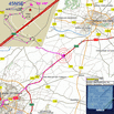
(visited by Henk Pouwels and Inge Pouwels) 19-Mar-2003 -- For a progress meeting of the GIFT project I was called to Valence. A few holidays around the meeting gave us a nice opportunity to travel by car from Amsterdam (Netherlands) to Valence and see something more of France and not to forget to buy some good French wines. We made an overnight stop in Contrexeville (see 48N6E) and stayed for two nights in Valence. Preparing the trip I realized a Confluence Point was as close as 8.5 km to our meeting room at THALES AVIONIC, which defined our plans for the return trip. The Degree Confluence Project is not my only interest in GPS. The just mentioned GIFT project is also related to GPS. GIFT stands for GNSS Inertial Future Landing Techniques. GNSS means Global Navigation Satellite System, a more general 'short' for GPS like systems. The project is a research project supported by the European Community with partners from France, Germany, Sweden, England, Portugal and the Netherlands. In popular translation it studies the possibilities of using GPS (and/or GALILEO in future) in combination with other existing aircraft sensors like Inertial Navigation Systems, for Precision Approach and CAT III automatic landings. Key issues are Accuracy, Continuity, Availability and Integrity. Integrity is translated into a chance of less then 1x10E-9 (less then once in 1.000.000.000 landings) the guidance system gives hazardous misleading information. See the website http://gift.skysoft.pt/ The confluence point. In contradiction to Philipe Brun (visit #1 and #2) and Jan Liska / Gerold Küchler (visit #3) we reached the spot in bright sunlight, with a clear blue sky and in springtime. The approach from Valence by the A49 was easy, turning off the main road in view of the petrol station to the secondary road B101, via the roundabout south, under the main road and via the roundabout north to the parking, see the map and plotted trajectory in image #5. Finally I walked 70m through the small field and took the standard pictures of the four principal directions see photographs #1, #2, #3 and #4. The grassy areas in the foreground of the photographs are all inside the 100m Confluence circle, even the road and the two trees in photograph #2 are inside the circle. Off line 200 fixes recorded over a 5 minutes time interval were calculated to an average distance of 2.5 m (0.75 m standard deviation) to the CP. My Garmin estimated the position error to be 3m. I managed to picture the GPS display (see image #5, right corner down) only 0.00001° in error (about 1m NS, 0.7m EW). The reported altitude is 183 m. Note the trip value of 1115 km which is measured from our home; another 1000 km and we can sleep in our own bed. The truck in photograph #3 is on the motorway A49, direction Valence. The roundabout board in photograph #1 shows how to go to Valence by motorway and shows the direction to Chateauneuf sur Isere which we took afterwards. The mentioned petrol station is in direction SE, an edge can be seen at the left side of the photograph #4. Close to the CP at 2 km SW, but not visible, is a railway station of the TGV = Transport Grande Vitesse = High Speed Train, connecting Paris with Marseille. The orchard N of the DCP was in full blossom, peaches I think (see photograph #6). Other flowers attracted my camera in the side of a trench surrounding the orchard (see photograph #7, wild blue violets (Latin name Viola Odorata) The day before a splendid full moon could not be ignored; photograph #8 shows the moon seen from an illuminated square in Valence. |
| All pictures |
| #1: The confluence in the foreground, seen to the West #2: The orchard with pink flowers to the North #3: The main road with truck seen to the East #4: The view to the south with petrol station at the left edge #5: Map, detailed map and GPS display #6: Orchard blossom in detail #7: Some wild violets #8: Full moon in Valence, the night before ALL: All pictures on one page |


![Visit #14: [22-Feb-24] Visit #14: [22-Feb-24]](/fr/all/n45e005v14/preview.jpg)
![Visit #13: [31-Dec-21] Visit #13: [31-Dec-21]](/fr/all/n45e005v13/preview.jpg)
![Visit #12: [05-Jul-20] Visit #12: [05-Jul-20]](/fr/all/n45e005v12/preview.jpg)
![Visit #11: [25-Jul-18] Visit #11: [25-Jul-18]](/fr/all/n45e005v11/preview.jpg)
![Visit #10: [04-May-13] Visit #10: [04-May-13]](/fr/all/n45e005v10/preview.jpg)
![Visit #9: [31-Dec-09] Visit #9: [31-Dec-09]](/fr/all/n45e005v9/preview.jpg)
![Visit #8: [07-Jun-08] Visit #8: [07-Jun-08]](/fr/all/n45e005v8/preview.jpg)
![Visit #7: [16-Jul-05] Visit #7: [16-Jul-05]](/fr/all/n45e005v7/preview.jpg)
![Visit #6: [12-Jul-04] Visit #6: [12-Jul-04]](/fr/all/n45e005v6/preview.jpg)
![Visit #5: [19-Jun-04] Visit #5: [19-Jun-04]](/fr/all/n45e005v5/preview.jpg)
![Visit #2: [30-Nov-01] Visit #2: [30-Nov-01]](/fr/all/n45e005v2/preview.jpg)
![Visit #3: [17-Nov-01] Visit #3: [17-Nov-01]](/fr/all/n45e005v3/preview.jpg)
![Visit #1: [11-Nov-01] Visit #1: [11-Nov-01]](/fr/all/n45e005/preview.jpg)