|
United States : Maine
7.0 miles (11.2 km) NE of New Sweden, Aroostook, ME, USA
Approx. altitude: 232 m
(761 ft)
([?] maps: Google MapQuest OpenStreetMap topo aerial ConfluenceNavigator)
Antipode: 47°S 112°E
Accuracy: 6 m (19 ft)
Quality: good
Click on any of the images for the full-sized picture.
| 47°N 68°W (visit #3) |
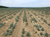
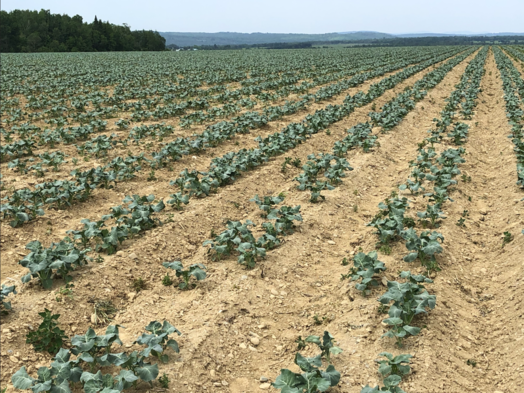 (visited by Woody Harrell) 02-Jul-2020 -- In the early 1800s, the first white settlers to Aroostook County started carving fields out of forest and immediately began planting potatoes. What they found was, unlike the marginal soils covering most of New England, the geologically distinct, well-drained, fertile loam soils of Aroostook, along with the cool northern climate, were perfect for growing the tuber vegetable. Over the next hundred years, Maine potato farmers continued to clear trees from hundreds of thousands of acres. Through the early 1950s the annual crop of almost a quarter million acres made Maine the leader in United States potato production. Since then, Maine’s Potato Empire has seriously waned, yet still today over 50,000 acres of potatoes are grown each year in Aroostook County (the largest American county by area east of the Mississippi River, and home to three confluence points). Thus, it is not surprising to find 47, -68 in a potato field! Turn east on Sheen Road off of US-1, then left on Cote Road, which curves uphill to the right, ending as a farm road paralleling 47°00\'00\"N. The point is located 233 feet due south of the farm road. Wet weather delayed much planting this spring, only to be followed by one of the driest Junes on record. As a result, the new plants were still small and low to the ground; and it was easy to navigate to the point on foot without damaging the young crop. 47, -68 is located on the former L-85 Nike missile launch site in Conner, Maine; and several now derelict structures from the cold War era remain nearby. Situated within the Loring Air Force Base Defense Area (designated L), the L-85 site was one of four Nike Ajax sites placed around Loring AFB for protection of the USAF Strategic Air Command B-52 Stratofortresses. Manned by the Regular Army 3rd Missile Battalion, 61st Air Defense Artillery, these sites provided defense for Loring and the northeastern approaches to the United States from September 1957 to June 1966. Sold as excess property to Blotner Trailer Sales, L-85 was soon repurchased by the government and used as an Air Force communications facility and satellite tracking site. The re-sale stipulated the facility would bear the name “Louis Blotner,” and the Blotner name still appears on Google Maps. The Louis Blotner Satellite Tracking Site No. 1 was finally closed in 1993 with the inactivation of nearby Loring Air Force Base. I could report this visit required a 1,738 mile drive from my home in Mississippi; but in fact I was recently blessed with twin granddaughters (my first!) who make their home less than eleven miles away on the Canadian border. Given the health apprehensions in this summer of COVID-19, I was hesitant to fly commercially for a visit, but the sight of those sweet little girls’ faces made the three day drive well worthwhile! |
| All pictures |
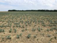
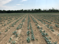
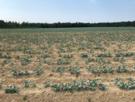
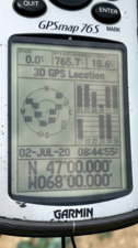
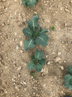
| #1: Looking southwest over a young Aroostook County potato crop towards Highway US-1. #2: Looking North. #3: Looking East. #4: Looking South. #5: Looking West. #6: GPS reading, easily obtained, with lots of bars. #7: Groundcover: Dusty young potato crop hoping for rain. #8: Derelict sentry post on US-1 (Not current confluence access point); “Detachment 2, 1000th Satellite Operations Group” sign; Abandoned interior with southeast view to confluence point. #9: The Masked Confluence Hunter (circa 2020); although in fact Aroostook County was reporting only one out of every 2,484 residents with COVID-19, and social distancing at the site was not an issue… ALL: All pictures on one page |



![Visit #2: [14-Sep-08] Visit #2: [14-Sep-08]](/us/me/n47w068v2/preview.jpg)
![Visit #1: [09-May-01] Visit #1: [09-May-01]](/us/me/n47w068/preview.jpg)