|


Russia : Respublika Altay
9.3 km (5.8 miles) SW of Oroktoy, Respublika Altay, Russia
Approx. altitude: 1532 m
(5026 ft)
([?] maps: Google MapQuest OpenStreetMap ConfluenceNavigator)
Antipode: 51°S 94°W
Accuracy: 10 m (32 ft)
Quality: good
Click on any of the images for the full-sized picture.
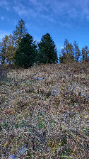
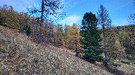
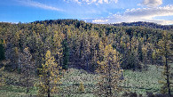
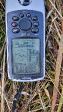
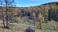
| 51°N 86°E (visit #4) | (secondary) |
![Visit #3: [08-Aug-05]](/ru/all/n51e086v3/preview.jpg "Visit #3: [08-Aug-05]")
![Visit #2: [17-Oct-04]](/ru/all/n51e086v2/preview.jpg "Visit #2: [17-Oct-04]")
![Visit #1: [08-May-04]](/ru/all/n51e086/preview.jpg "Visit #1: [08-May-04]")
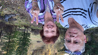
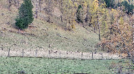
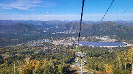
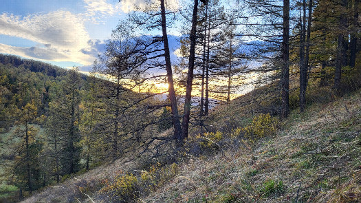 (visited by Valera Parshukov and Oktiabrina Parshukova) 22-Сентября-2024 – Мы приехали в Горный Алтай на курорт "Манжерок" отдохнуть и отметить день рождения дочери. В предпоследний день пребывания на курорте в первой половине дня мы с удовольствием прогулялись по тропе здоровья, а во второй половине решили прокатиться к одному из самых живописных и мистических мест Алтая – озеру Манас или посетить конфлюенцию 51°N 86°E. Мне давно хотелось повторить поездку к этому пересечению и уточнить из двух посещений, кто прав и кто ошибся с фотографиями на восток и запад. Победил вариант с поиском истины. Я решил доехать коротким маршрутом через село Ороктой. Этот путь оказался более сложным, трудным и крутым на подъём по сравнению с прошлым визитом. Ситуация осложнялась крупными камнями при подъёме, в горной части – последствиями недавно выпавшим обильным снегом и также резко начавшим таять. В этот раз я смог подъехать на 170 м к цели. Ещё ниже спускаться было опасно из-за крутой и покрытой обильной грязью дороги. Обратно машина могла не выехать. Пересечение находится на южном склоне в горной местности в Онгудайском районе Республики Алтай. Из деревьев произрастают лиственница, кедр, ель и берёза. А я всё-таки оказался прав, где восток и где запад. Наступали сумерки и я решил возвращаться на курорт по длинному, но более безопасному маршруту через Семинский перевал. За 12 км до села Нижняя Талда я расслабился и посадил машину на брюхо в болотину. Минут 15 я пытался вырваться из плена, но бесполезно. И вдруг впереди в 200 метрах с горы спускается автомобиль, бортовой УАЗик. Это было везение, меня заметили, и мы были спасены. Местные жители вывозили собранный урожай кедрового ореха из леса. Больше приключений не было в этот день, и мы ночевали в тёплой уютной постели, отмытые от грязи. Данные посещения:
22-Sep-2024 – We came to the Altai Mountains to the "Manzherok" resort to relax and celebrate our daughter's birthday. On the penultimate day of our stay, we enjoyed a morning walk along the Health Trail. In the afternoon, we decided to take a trip to one of the most picturesque and mystical places in Altai — Lake Manas — or visit the confluence at 51°N 86°E. I had long wanted to return to this confluence to settle a debate from two pervious visits: who was right and who was wrong about which photos faced east and which faced west? In the end, the quest for truth won. I decided to take the shorter route through the village of Oroktoy. This path turned out to be much tougher, more challenging, and steeper than during my last trip. The climb was made even harder by large boulders, while the mountain sections were slick from a recent heavy snowfall that had suddenly started to melt. This time, I managed to drive within 170 meters of the goal. Going any lower was too risky due to the steep, incredibly muddy track—there was a real chance the car wouldn’t make it back up. The confluence places on a southern slope in the mountainous terrain of the Ongudaysky District of the Altai Republic. The forest here is a mix of larch, cedar, spruce, and birch trees. And as it turns out, I was right all along about which way was east and which was west! As dusk began to fall, I decided to head back to the resort via a longer but safer route over the Seminsky Pass. Just 12 kilometers before the village of Nizhnyaya Talda, I let my guard down and got the car high-centered in a bog. For about 15 minutes, I tried to break free from the trap, but it was useless. Suddenly, just 200 meters ahead, a flatbed UAZ truck started driving down the mountain. Talk about luck! They spotted us, and we were saved. It was local residents hauling their harvested pine nuts out of the forest. There were no more adventures that day, and we spent the night in a warm, cozy bed, completely washed clean of all the mud. Visit data:
|
| All pictures |
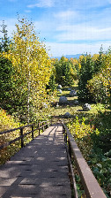
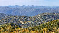
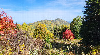
| #1: West / Запад #2: North / север (ver) #3: East / восток #4: South / юг #5: GPS reading (ver) #6: View towards parking / вид в сторону парковки #7: Visitors / визитеры #8: Altai deer / маралы #9: Manzherok / Манжерок #10: Health trail / тропа здоровья (ver) #11: View 1 from Health trail / вид с тропы здоровья 1 #12: View 2 from Health trail / вид с тропы здоровья 2 ALL: All pictures on one page |