|

Russia : Leningradskaya oblast'
6.0 km (3.7 miles) NNW of Sosnovi Bor, Leningradskaya oblast', Russia
Approx. altitude: 0 m
(0 ft)
([?] maps: Google MapQuest OpenStreetMap ConfluenceNavigator)
Antipode: 60°S 151°W
Accuracy: 22 m (72 ft)
Quality: good
Click on any of the images for the full-sized picture.


| 60°N 29°E (visit #1) | (secondary) |
![Visit #2: [25-Aug-04]](/ru/all/n60e029v2/preview.jpg "Visit #2: [25-Aug-04]")

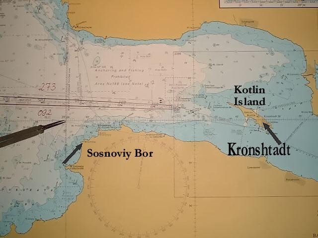
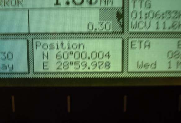
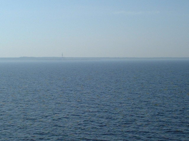
(visited by Captain Peter, Valentyn Smirnov, Volodymyr Kokorev and Volodymyr Sydorenko) 01-May-2002 -- And full ahead in the Gulf of Finland! Gogland Island is passed and now we approach 60°N/29°E. Our position was 60°00,004'N and 28°59,978'E, 21.5 meters in the W of the confluence. The closest settlement is Sosnoviy Bor, which means "Fir Tree Forest". From this position it is another 2 hours to Kronshadt, where the pilot for Saint Petersburg embarks. 01-05-2002 -- И “Полный вперёд” в Финском заливе! Остров Гогланд пройден, и мы приближаемся к точке с координатами 60°N/29°E. Наша позиция 60°00,004'N и 28°59,978'E, 20.5 метров на запад oт точки пересечения меридиана и параллели. Ближайший ориентир – поселение Сосновый бор. Отсюда два часа полным ходом до острова Кронштадт, где мы возьмём лоцмана, который проведёт нас в Санкт-Петербург. |
| All pictures |
| #1: Sosnoviy Bor #2: Map #3: GPS ALL: All pictures on one page |
| Notes |
|
In the Gulf of Finland. |