|

Italy : Lombardia
1.9 km (1.2 miles) N of San Rocco, Mantova, Lombardia, Italy
Approx. altitude: 13 m
(42 ft)
([?] maps: Google MapQuest OpenStreetMap ConfluenceNavigator)
Antipode: 45°S 169°W
Accuracy: 20 m (65 ft)
Quality: good
Click on any of the images for the full-sized picture.


")

![]()


| 45°N 11°E (visit #2) |
![Visit #8: [16-Sep-23]](/it/all/n45e011v8/preview.jpg "Visit #8: [16-Sep-23]")
![Visit #7: [13-Oct-21]](/it/all/n45e011v7/preview.jpg "Visit #7: [13-Oct-21]")
![Visit #6: [15-May-11]](/it/all/n45e011v6/preview.jpg "Visit #6: [15-May-11]")
![Visit #5: [29-Dec-10]](/it/all/n45e011v5/preview.jpg "Visit #5: [29-Dec-10]")
![Visit #4: [21-Jun-09]](/it/all/n45e011v4/preview.jpg "Visit #4: [21-Jun-09]")
![Visit #3: [01-May-08]](/it/all/n45e011v3/preview.jpg "Visit #3: [01-May-08]")
![Visit #1: [02-May-01]](/it/all/n45e011/preview.jpg "Visit #1: [02-May-01]")

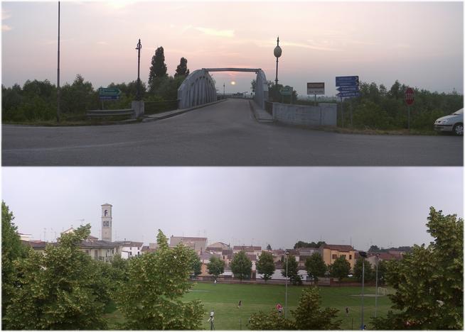
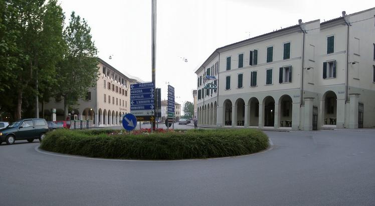
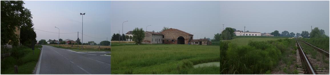
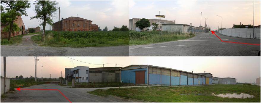
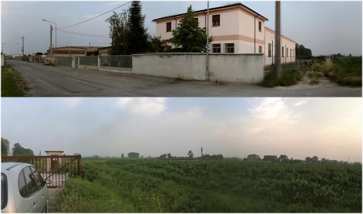
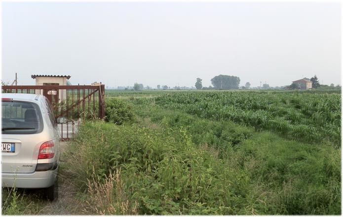
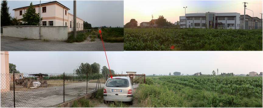
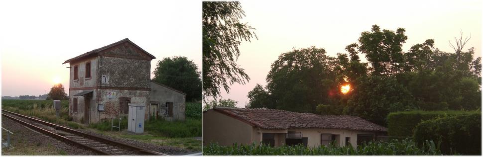
(visited by Hans Augdoppler) 11-Jun-2002 -- On the national highway SS496 I crossed the river Sécchi; from the dam you have a good view of the city of Quistello. After passing through the city towards the southwest you finally reach the railway crossing nearby the CP. Just about 200 m before the tracks and shortly after city limit the access road to the industrial area of Quistello leads you in easterly direction. A signpost points to the company ‘Topvision TVCOLOR' – a building close to the CP. Along a number of companies I reached the junction to the road (45.0031°N 11.0027°E) in the direction of the CP. The dead end leads parallel to the train tracks to the destination point westward. The corn field is situated just after the last corporate building (southern). A narrow path leads up to a locked paled gate at the western side of the building. The exact point then is about 20 m to the southwest and a deep, overgrown ditch separates the corn field from the industrial area. As visitor #1 already mentioned obviously there isn't any bridge crossing over the ditch. A possibility would be to walk along the railroad tracks (~ 400 m) to access the field. I rejected this thought in the face of the twilight, took another couple of pictures of the sunset and left the place again. |
| All pictures |
| #1: Confluence behind the gate in the corn field #2: River Sécchi bridge & from NORTH #3: Access route trough industrial area of Quistello #4: Path to gate and panoramic view of CP area (S-W) #5: Nearby corporate buildings & backyard #6: Entry to industrial area & railway crossing #7: Sunset at railway crossing #8: Map with GPS reading #9: City centre of Quistello ALL: All pictures on one page |