
| { Main | Search | Countries | Information | Member Page } | |
United States : Texas; showing visits by Joseph Kerski |
| There are no Plans for this Region. |
| Region Notes |
|
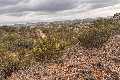
34°N 101°W 6.4 miles (10.3 km) NE of Dougherty (Floyd), Motley, TX, USA [03-Jul-26] |
|
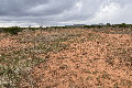
33°N 101°W 11.2 miles (18.0 km) NE of Fluvanna (Scurry), Kent, TX, USA [03-Jul-26] |
|
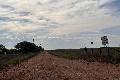
33°N 100°W 5.9 miles (9.5 km) SSW of Sagerton (Haskell), Stonewall, TX, USA [incomplete] [03-Jul-26] |
|
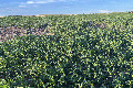
32°N 100°W 3.7 miles (6.0 km) NW of Winters, Runnels, TX, USA [03-Jul-26] |
|
32°N 99°W 1.8 miles (2.9 km) SE of Williams, Brown, TX, USA [03-Jul-26] |
|
32°N 95°W 5.7 miles (9.1 km) ENE of New Summerfield, Cherokee, TX, USA [25-Jun-26] |
|
34°N 103°W 8.9 miles (14.3 km) N of Goodland, Bailey, TX, USA [11-May-25] |
|
30°N 98°W 5.9 miles (9.5 km) E of Wimberley, Hays, TX, USA [incomplete] [19-Mar-16] |
|
31°N 95°W 2.8 miles (4.5 km) SE of Woodlake, Trinity, TX, USA [31-Dec-15] |
|
31°N 94°W 5.5 miles (8.8 km) N of Jasper, Jasper, TX, USA [31-Dec-15] |
|
33°N 99°W 3.3 miles (5.3 km) ESE of Woodson, Throckmorton, TX, USA [22-Jun-15] |
|
34°N 99°W 5.1 miles (8.2 km) WSW of Electra (Wichita), Wilbarger, TX, USA [22-Jun-15] |
|
33°N 103°W 10.2 miles (16.4 km) WNW of Denver City, Yoakum, TX, USA [17-Feb-15] |
|
32°N 102°W 4.6 miles (7.4 km) E of Midland, Midland, TX, USA [13-Feb-15] |
|
33°N 102°W 2.4 miles (3.9 km) SE of New Moore, Lynn, TX, USA [22-Jan-15] |
|
32°N 98°W 2.3 miles (3.7 km) NE of Hico, Hamilton, TX, USA [15-May-14] |
|
33°N 95°W 2.0 miles (3.2 km) W of Pittsburg, Camp, TX, USA [11-Feb-14] |

|
33°N 97°W 3.2 miles (5.1 km) S of Lewisville, Denton, TX, USA [25-May-13] |
|
33°N 96°W 3.5 miles (5.6 km) W of Lone Oak, Hunt, TX, USA [25-May-13] |
|
31°N 96°W 6.3 miles (10.1 km) NW of Madisonville, Madison, TX, USA [28-Nov-12] |
|
30°N 97°W 1.0 miles (1.7 km) SE of Winchester, Fayette, TX, USA [28-Nov-12] |
|
33°N 98°W 2.8 miles (4.5 km) NNE of Whitt, Parker, TX, USA [09-Jul-11] |
|
31°N 97°W 1.1 miles (1.7 km) S of Burlington, Milam, TX, USA [26-Feb-10] |
|
31°N 98°W 5.6 miles (9.0 km) S of Kempner (Lampasas), Burnet, TX, USA [16-Feb-10] |
|
33°N 97°W 3.2 miles (5.1 km) S of Lewisville, Denton, TX, USA [04-Apr-09] |
|
32°N 97°W 2.1 miles (3.5 km) N of Bynum, Hill, TX, USA [04-Apr-09] |
|
29°N 98°W 1.6 miles (2.6 km) NE of Falls City, Karnes, TX, USA [16-Mar-09] |
|
30°N 96°W 4.6 miles (7.4 km) SSE of Pine Island, Waller, TX, USA [14-Jan-09] |
|
29°N 96°W 2.2 miles (3.5 km) NW of Bay City, Matagorda, TX, USA [14-Jan-09] |

|
32°N 96°W 3.3 miles (5.3 km) NNW of Cayuga, Anderson, TX, USA [06-Apr-07] |

|
28°N 97°W 3.6 miles (5.8 km) ESE of Rockport, Aransas, TX, USA [20-Mar-06] |

|
28°N 99°W 21.8 miles (35.1 km) E of Encinal (La Salle), Webb, TX, USA [20-Mar-06] |
|
28°N 98°W 2.6 miles (4.2 km) NNW of Westdale, Jim Wells, TX, USA [31-Mar-05] |
|
33°N 97°W 3.2 miles (5.1 km) S of Lewisville, Denton, TX, USA [14-Mar-05] |

|
33°N 97°W 3.2 miles (5.1 km) S of Lewisville, Denton, TX, USA [23-Jan-04] |
|
30°N 99°W 4.4 miles (7.1 km) NNE of Center Point, Kerr, TX, USA [14-Jul-03] |
|
30°N 100°W 12.3 miles (19.9 km) E of Rocksprings, Edwards, TX, USA [24-Jun-03] |
|
30°N 98°W 5.9 miles (9.5 km) E of Wimberley, Hays, TX, USA [24-Jun-03] |
Region Notes:
The Texas Department of Transportation has their Texas Official Travel Map available for download as a PDF file. The map includes latitude/longitude grid tic marks that have been placed at the Degree Confluences. Information on the map projections used in Texas can be found at the TNRIS website.