|

Peru : Lima
near Lurigancho, Lima, Peru
Approx. altitude: 218 m
(715 ft)
([?] maps: Google MapQuest OpenStreetMap ConfluenceNavigator)
Antipode: 12°N 103°E
Accuracy: 7 m (22 ft)
Quality: good
Click on any of the images for the full-sized picture.


")


| 12°S 77°W (visit #5) |
![Visit #12: [22-Sep-23]](/pe/all/s12w077v12/preview.jpg "Visit #12: [22-Sep-23]")
![Visit #11: [24-Jul-21]](/pe/all/s12w077v11/preview.jpg "Visit #11: [24-Jul-21]")
![Visit #9: [17-Mar-19]](/pe/all/s12w077v9/preview.jpg "Visit #9: [17-Mar-19]")
![Visit #8: [06-Jul-15]](/pe/all/s12w077v8/preview.jpg "Visit #8: [06-Jul-15]")
![Visit #7: [28-Dec-14]](/pe/all/s12w077v7/preview.jpg "Visit #7: [28-Dec-14]")
![Visit #6: [07-Aug-11]](/pe/all/s12w077v6/preview.jpg "Visit #6: [07-Aug-11]")
![Visit #4: [30-Aug-06]](/pe/all/s12w077v4/preview.jpg "Visit #4: [30-Aug-06]")
![Visit #3: [11-Sep-04]](/pe/all/s12w077v3/preview.jpg "Visit #3: [11-Sep-04]")
![Visit #2: [04-Apr-04]](/pe/all/s12w077v2/preview.jpg "Visit #2: [04-Apr-04]")
![Visit #1: [07-Jul-02]](/pe/all/s12w077/preview.jpg "Visit #1: [07-Jul-02]")
![Visit #10: [26-Mar-21]](/pe/all/s12w077v10/preview.jpg "Visit #10: [26-Mar-21]")

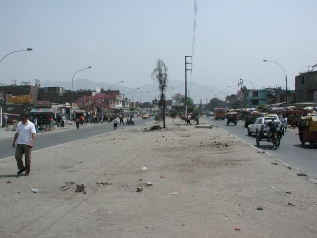
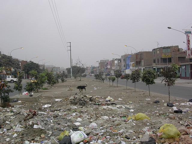
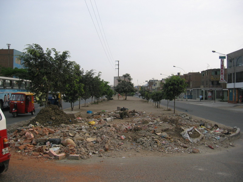
(visited by Rainer Mautz, Magno Madueno, Elionora and Anibal Madueno) 21-Dec-2008 -- General information about the tour Having learned Spanish for two months and being equipped with two small back-packs (together 12 kg), we had a whole month to spend in South America. Although being passionate confluence hunters, we reached “only” nine confluence points and “just” three of them had not been visited previously. Well, this low-yield has reasons. Most of the time, we were relying on public transportation. The road network in Peru and Bolivia is not dense and overland busses in the hinterland run often less than once a day. If a train service between two towns has not yet been abandoned a typical timetable would note that the train leaves “Mondays at 3 a.m. and returns Thursdays 11 p.m.”. Those confluences that remain without report are hard to reach, far off from the tourist track, oftentimes located in the deep jungle. In December and January is the rainy season at its best and many roads are impassable. I had to capitulate several times driving past nearby virgin confluence points simply due to the lack of transportation. The trip started and ended in Peru’s capital city Lima, in-between we traveled through Bolivia’s highlands and Chile’s North. A kml-map of the tour can be downloaded for viewing in Google Earth of Google Maps here. Information about this confluence Not two hours after our arrival on the continent, we reached already this confluence point. From Lima airport we took a taxi to the city center, where we met Magno, a colleague of Elionora. When I told him my intention to visit this confluence, we were all surprised: his home was in the same neighborhood called “Las Flores”, just a 20-minute walk away. We took a taxi to the confluence and after the confluence visit we walked to his home, were his sister had prepared great Queso Frito & Chuño (fried cheese with dried potatoes). This urban confluence is remarkable. Located exactly in the middle of a main road directly at the center of an intersection with another street, getting there is as simple as it can get. It is interesting to see how the trees are growing over the years: 2004, 2006 and 2008. The pile garbage however seems also to grow by the time. CP Visit Details:
Story continues at 15°S 75°W. |
||||||||||
| All pictures | ||||||||||
| #1: The Confluence from 15 m #2: GPS Reading #3: Ground Zero #4: The Confluence Hunters #5: Historical Balcony in Lima #6: Dinner (Queso Frito & Chuño) #7: View to the South #8: View to the West #9: View to the North #10: View to the East ALL: All pictures on one page | ||||||||||
| Pending visits | ||||||||||
|
||||||||||
| Notes | ||||||||||
|
Close to the intersection of Av. Santa Rosa De Lima and Los Minerales. |