|

United Kingdom : England
2.2 km (1.4 miles) SSE of Raydon, Suffolk, England, United Kingdom
Approx. altitude: 47 m
(154 ft)
([?] maps: Google MapQuest OpenStreetMap ConfluenceNavigator)
Antipode: 52°S 179°W
Accuracy: 6 m (19 ft)
Quality: good
Click on any of the images for the full-sized picture.


| 52°N 1°E (visit #2) |
![Visit #17: [07-Jun-24]](/uk/en/n52e001v17/preview.jpg "Visit #17: [07-Jun-24]")
![Visit #16: [22-Dec-15]](/uk/en/n52e001v16/preview.jpg "Visit #16: [22-Dec-15]")
![Visit #15: [22-Jan-10]](/uk/en/n52e001v15/preview.jpg "Visit #15: [22-Jan-10]")
![Visit #14: [02-May-09]](/uk/en/n52e001v14/preview.jpg "Visit #14: [02-May-09]")
![Visit #13: [04-Aug-07]](/uk/en/n52e001v13/preview.jpg "Visit #13: [04-Aug-07]")
![Visit #12: [17-Feb-07]](/uk/en/n52e001v12/preview.jpg "Visit #12: [17-Feb-07]")
![Visit #11: [16-May-06]](/uk/en/n52e001v11/preview.jpg "Visit #11: [16-May-06]")
![Visit #10: [16-May-06]](/uk/en/n52e001v10/preview.jpg "Visit #10: [16-May-06]")
![Visit #9: [22-Jan-06]](/uk/en/n52e001v9/preview.jpg "Visit #9: [22-Jan-06]")
![Visit #8: [26-Sep-05]](/uk/en/n52e001v8/preview.jpg "Visit #8: [26-Sep-05]")
![Visit #7: [16-Jul-05]](/uk/en/n52e001v7/preview.jpg "Visit #7: [16-Jul-05]")
![Visit #6: [06-Feb-05]](/uk/en/n52e001v6/preview.jpg "Visit #6: [06-Feb-05]")
![Visit #5: [13-Dec-04]](/uk/en/n52e001v5/preview.jpg "Visit #5: [13-Dec-04]")
![Visit #4: [05-Aug-04]](/uk/en/n52e001v4/preview.jpg "Visit #4: [05-Aug-04]")
![Visit #3: [17-Apr-04]](/uk/en/n52e001v3/preview.jpg "Visit #3: [17-Apr-04]")
![Visit #1: [07-Mar-01]](/uk/en/n52e001/preview.jpg "Visit #1: [07-Mar-01]")

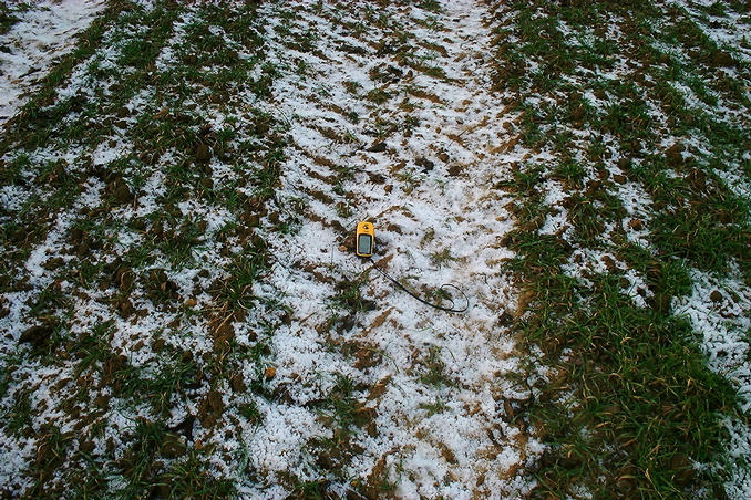
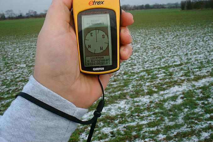
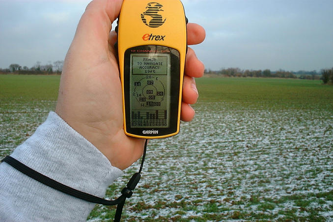
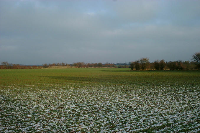
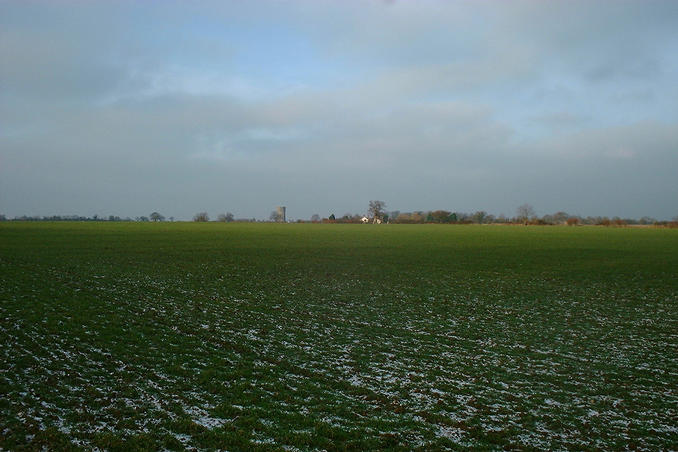
(visited by Gordon Spence) 03-Jan-2002 -- The first visit of the New Year, I was going to the office today and looking at the map I realised it was only a slight (100 mile) detour to take in this point. Additionally, there was one crucial factor, it is currently -8C over here, if you have been following my series then you'll know that confluence points and muddy fields go hand in hand. The freezing temperature should ensure a "dry" visit.... As usual I navigated to within a couple of miles of the point using my trusty new 2002 printed road Atlas - sometimes the old ways are the best - then the map printed from the link on this site, soon homed me in to within about 500 yards. I noticed that this field had also had a winter crop planted and there was again tractor tracks to follow. I walked around the edge until I hit a track...the edge of the field was a bit sticky where the sun had melted the frost...but the tracks were good and firm. Following the tracks I soon realised that this time the point was actually smack in the middle of one! Having got the GPS to lock on I took the standard "on the spot" shot, and the "accuracy" shot. Looking North there is actually nothing to see, even though my car is actually straight ahead. I then turned West, in the middle of the picture is the old water tower in the village of Raydon. That is the most Easterly point of the UK visited with an accuracy figure filled in, and the entire block surrounding where I live...now they get further and further away... |
| All pictures |
| #1: Location shot looking North #2: On the exact spot #3: Accuracy - 9 satellites #4: Looking West to Raydon #5: The exact spot is in tractor tyre ruts! ALL: All pictures on one page |