
| { Main | Search | Countries | Information | Member Page } | |
Rainer Mautz's confluences |
| Mautz, Rainer | homepage | |
| This Visitor does not have any Plans. | View confluence map | |
| 978 visits (950 unique) in 122 countries: | 978 active, 0 pending, 0 submitting | |
| 891 successful (865 unique): | 783 primary, 103 secondary, 5 special | |
| 87 incomplete (86 unique): | 84 primary, 3 secondary | |
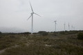
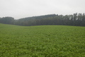
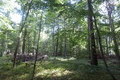
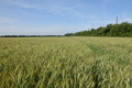
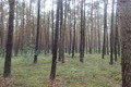 | 53°N 11°E 1.1 km (0.7 miles) W of Waddewitz-Zebelin, Niedersachsen, Germany [secondary] [25-Jul-14] |
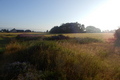
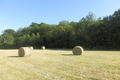 | 48°N 4°E 2.2 km (1.4 miles) NE of Bernon, Aube, Grand Est, France [15-Jun-14] |
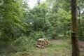
 | 48°N 5°E 3.9 km (2.4 miles) NNE of Cour l'Évêque, Haute-Marne, Grand Est, France [14-Jun-14] |
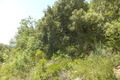
 | 48°N 6°E 3.1 km (1.9 miles) NE of Regnévelle, Vosges, Grand Est, France [14-Jun-14] |
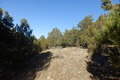
 | 43°N 11°E 2.3 km (1.4 miles) SW of Tatti, Grosseto, Toscana, Italy [09-Jun-14] |
 | 19°N 71°W 10.2 km (6.3 miles) NW of Yaque, San Juan, Dominican Republic [incomplete] [16-Apr-14] |
 | 19°N 70°W 5.1 km (3.2 miles) SE of La Cueva, Sánchez Ramírez, Dominican Republic [13-Apr-14] |
 | 19°N 69°W 5.6 km (3.5 miles) ENE of Miches, El Seíbo, Dominican Republic [13-Apr-14] |
 | 49°N 12°E 2.2 km (1.4 miles) SSE of Sinzing-Eilsbrunn, Bayern, Germany [05-Apr-14] |
 | 43°N 3°E 1.9 km (1.2 miles) N of Lapalme, Aude, Occitanie, France [30-Mar-14] |
 | 44°N 2°E 2.3 km (1.4 miles) NE of Cestayrols, Tarn, Occitanie, France [28-Mar-14] |
 | 44°N 1°E near Saint-Arroumex, Tarn-et-Garonne, Occitanie, France [28-Mar-14] |
 | 44°N 3°E 2.3 km (1.4 miles) NE of Roquefort-sur-Soulzon, Aveyron, Occitanie, France [15-Mar-14] |
 | 44°N 4°E 2.3 km (1.4 miles) SW of Massillargues-Attuech, Gard, Occitanie, France [14-Mar-14] |
 | 40°N 0° 3.4 km (2.1 miles) ENE of Castellón de la Plana, Castellón, Valencia, Spain [24-Feb-14] |
 | 40°N 1°W 2.3 km (1.4 miles) SE of La Higuera, Teruel, Aragón, Spain [23-Feb-14] |
 | 39°N 1°W 4.0 km (2.5 miles) NNE of La Torre, Valencia, Valencia, Spain [incomplete] [22-Feb-14] |
 | 49°N 2°E 1.9 km (1.2 miles) N of Triel-sur-Seine, Yvelines, Île-de-France, France [secondary] [27-Jan-14] |
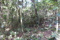
 | 22°N 96°E 1.7 km (1.1 miles) W of Sinywa, Sagaing, Myanmar (Burma) [12-Jan-14] |
 | 21°N 95°E 2.5 km (1.6 miles) SW of Kunywa, Mandalay, Myanmar (Burma) [10-Jan-14] |
 | 17°N 96°E 2.6 km (1.6 miles) SE of Tantabin, Yangon, Myanmar (Burma) [08-Jan-14] |
 | 15°N 98°E 5.2 km (3.2 miles) NW of Lawthaing, Tanintharyi, Myanmar (Burma) [02-Jan-14] |
 | 14°N 99°E 20.1 km (12.5 miles) E of Sindaung, Tanintharyi, Myanmar (Burma) [incomplete] [30-Dec-13] |
 | 44°N 6°E 3.9 km (2.4 miles) SSE of Les Mées, Alpes-de-Haute-Provence, Provence-Alpes-Côte d'Azur, France [07-Dec-13] |
 | 44°N 7°E 1.3 km (0.8 miles) E of Rigaud, Alpes-Maritimes, Provence-Alpes-Côte d'Azur, France [06-Dec-13] |
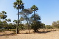
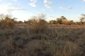
 | 24°S 26°E 20.4 km (12.7 miles) E of Inkangwe (Kweneng), Kgatleng, Botswana [23-Nov-13] |
 | 22°S 27°E 9.0 km (5.6 miles) SE of Ditauana, Central, Botswana [incomplete] [22-Nov-13] |
 | 21°S 27°E 29.9 km (18.6 miles) WSW of Sebina (North-East), Central, Botswana [21-Nov-13] |
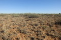
 | 23°S 22°E 18.9 km (11.7 miles) E of Barachu, Ghanzi, Botswana [18-Nov-13] |
 | 24°S 23°E 8.7 km (5.4 miles) WSW of Morwamotsu (Kweneng), Kgalagadi, Botswana [17-Nov-13] |
 | 24°S 24°E 10.3 km (6.4 miles) E of Dutlwe, Kweneng, Botswana [17-Nov-13] |
 | 24°S 25°E 13.8 km (8.6 miles) NNW of Letlhakeng, Kweneng, Botswana [incomplete] [17-Nov-13] |
 | 48°N 16°E 1.2 km (0.7 miles) W of Sulzbach, Niederösterreich, Austria [29-Sep-13] |
 | 48°N 15°E 2.2 km (1.4 miles) NW of Gresten, Niederösterreich, Austria [28-Sep-13] |
 | 48°N 14°E 2.2 km (1.4 miles) SE of Spieldorf, Oberösterreich, Austria [28-Sep-13] |
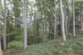
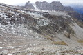
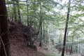 | 46°N 11°E 2.3 km (1.4 miles) SE of Lasino, Trento, Trentino-Alto Adige, Italy [16-Sep-13] |
 | 47°N 12°E 2.2 km (1.4 miles) SW of Sankt Jakob/San Giacomo, Bolzano, Trentino-Alto Adige, Italy [15-Sep-13] |
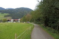
 | 47°N 13°E 6.9 km (4.3 miles) ENE of Zirknitz, Kärnten, Austria [14-Sep-13] |
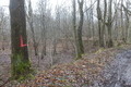
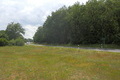
 | 45°N 4°E near Lantriac, Haute-Loire, Auvergne-Rhône-Alpes, France [17-Aug-13] |
 | 46°N 4°E 1.3 km (0.8 miles) E of Lentigny, Loire, Auvergne-Rhône-Alpes, France [17-Aug-13] |
 | 56°N 12°E 1.0 km (0.6 miles) E of Frederiksværk-Melby, Sjælland (Island), Frederiksborg, Denmark [21-Jul-13] |
 | 56°N 13°E 2.1 km (1.3 miles) E of Skromberga, Skåne, Sweden [21-Jul-13] |
 | 70°N 54°W 38.5 km (23.9 miles) WSW of Qullissat, Vestgrønland, Greenland [incomplete] [12-Jul-13] |
 | 67°N 54°W 16.0 km (9.9 miles) WNW of Holsteinborg, Vestgrønland, Greenland [incomplete] [06-Jul-13] |
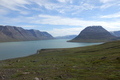
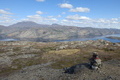
 | 67°N 53°W 12.5 km (7.8 miles) NNW of Sarfannguaq, Vestgrønland, Greenland [secondary] [04-Jul-13] |
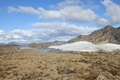
 | 67°N 52°W 25.2 km (15.6 miles) NE of Saqqarliit, Vestgrønland, Greenland [incomplete] [02-Jul-13] |
 | 67°N 51°W 3.4 km (2.1 miles) WNW of Camp Lloyd, Vestgrønland, Greenland [secondary] [30-Jun-13] |
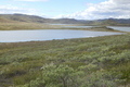
 | 67°N 50°W 30.4 km (18.9 miles) E of Søndre Strømfjord, Vestgrønland, Greenland [incomplete] [29-Jun-13] |
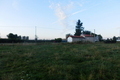
 | 52°N 11°E near Eilsdorf, Sachsen-Anhalt, Germany [secondary] [16-Jun-13] |
 | 53°N 12°E near Bad Wilsnack-Grube, Brandenburg, Germany [15-Jun-13] |
 | 52°N 12°E near Moritz-Schora, Sachsen-Anhalt, Germany [15-Jun-13] |
 | 45°N 5°E 4.5 km (2.8 miles) NW of Alixan, Drôme, Auvergne-Rhône-Alpes, France [04-May-13] |
 | 44°N 5°E 3.7 km (2.3 miles) S of Monteux, Vaucluse, Provence-Alpes-Côte d'Azur, France [04-May-13] |
 | 35°N 34°E 1.0 km (0.6 miles) N of Agía Nápa, Ammóchōstos/Gazimağusa, Cyprus [31-Mar-13] |
 | 35°N 33°E 2.7 km (1.7 miles) NE of Kannavia, Lefkōsía/Lefkoşa, Cyprus [29-Mar-13] |
 | 19°N 99°E 2.9 km (1.8 miles) NE of Ban Mai, Chiang Mai, Thailand [25-Feb-13] |
 | 18°N 99°E 2.8 km (1.7 miles) WSW of Ban Pa Tung, Lamphun, Thailand [24-Feb-13] |
 | 17°N 99°E 1.8 km (1.1 miles) E of Ban Wang Mo, Tak, Thailand [23-Feb-13] |
 | 16°N 100°E 6.6 km (4.1 miles) SSW of Ban Dan Chang, Nakhon Sawan, Thailand [22-Feb-13] |
 | 15°N 100°E 3.6 km (2.2 miles) W of Ban Tha Wa, Chai Nat, Thailand [21-Feb-13] |
 | 14°N 100°E near Kamphaeng Saen, Nakhon Pathom, Thailand [20-Feb-13] |
 | 13°N 100°E 3.6 km (2.2 miles) E of Ban Nong Mai Luang, Phetchaburi, Thailand [19-Feb-13] |
 | 10°N 99°E 5.9 km (3.7 miles) NNE of Ban Khlong Krim, Chumphon, Thailand [14-Feb-13] |
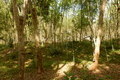 | 9°N 99°E 1.9 km (1.2 miles) N of Ban Nong Ri, Surat Thani, Thailand [13-Feb-13] |
 | 8°N 100°E 3.7 km (2.3 miles) N of Cha-uat, Nakhon Si Thammarat, Thailand [11-Feb-13] |
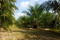
 | 6°N 102°E 1.9 km (1.2 miles) N of Kampong Gual Batu, Kelantan, Malaysia [09-Feb-13] |
 | 5°N 103°E 2.6 km (1.6 miles) SE of Kampong Mekan, Terengganu, Malaysia [08-Feb-13] |
 | 4°N 103°E 2.6 km (1.6 miles) NW of Kampong Jin, Pahang, Malaysia [05-Feb-13] |
 | 3°N 103°E 5.6 km (3.5 miles) E of Kampong Meripoh, Pahang, Malaysia [04-Feb-13] |
 | 2°N 103°E 3.7 km (2.3 miles) E of Pasir, Johor, Malaysia [03-Feb-13] |
 | 15°S 167°E 2.6 km (1.6 miles) NW of Lotabone, Espiritu Santo (Island), Sanma, Vanuatu [23-Jan-13] |
 | 8°S 113°E 11.8 km (7.3 miles) NW of Kandangtepus, Jawa Timur, Indonesia [incomplete] [04-Jan-13] |
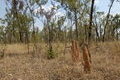 | 17°S 144°E 6.1 km (3.8 miles) WNW of Arbouin, QLD, Australia [18-Dec-12] |
 | 18°S 146°E 2.5 km (1.6 miles) SW of Lower Tully, QLD, Australia [15-Dec-12] |
 | 19°S 146°E 20.2 km (12.5 miles) W of Paluma, QLD, Australia [13-Dec-12] |
 | 20°S 147°E 15.9 km (9.9 miles) NE of Ravenswood, QLD, Australia [11-Dec-12] |
 | 20°S 146°E 23.4 km (14.5 miles) SSW of Basalt, QLD, Australia [incomplete] [10-Dec-12] |
 | 22°S 147°E 31.8 km (19.7 miles) NW of Frankfield, QLD, Australia [07-Dec-12] |
 | 23°S 148°E 3.9 km (2.4 miles) E of Khosh Bulduk, QLD, Australia [05-Dec-12] |
 | 26°S 153°E 2.9 km (1.8 miles) NW of Cooloola, QLD, Australia [28-Nov-12] |
 | 27°S 153°E 5.5 km (3.4 miles) ENE of Elimbah, QLD, Australia [26-Nov-12] |
 | 28°S 153°E 1.5 km (0.9 miles) SSE of Beaudesert, QLD, Australia [24-Nov-12] |
 | 29°S 153°E 3.1 km (1.9 miles) ENE of Coombell, NSW, Australia [23-Nov-12] |
 | 30°S 153°E 2.2 km (1.4 miles) SE of Kremnos, NSW, Australia [incomplete] [22-Nov-12] |
 | 31°S 153°E 1.4 km (0.9 miles) SE of Kinchela, NSW, Australia [21-Nov-12] |
 | 32°S 152°E 4.0 km (2.5 miles) ENE of Gloucester, NSW, Australia [19-Nov-12] |
 | 36°S 149°E 8.8 km (5.5 miles) SSE of Shannons Flat, NSW, Australia [09-Nov-12] |
 | 36°S 148°E 5.7 km (3.5 miles) SW of Tooma, NSW, Australia [07-Nov-12] |
 | 36°S 147°E 2.1 km (1.3 miles) NE of Ettamogah, NSW, Australia [06-Nov-12] |
 | 37°S 146°E 5.5 km (3.4 miles) ENE of Maindample, VIC, Australia [05-Nov-12] |
 | 38°S 146°E 2.5 km (1.6 miles) S of Neerim East, VIC, Australia [03-Nov-12] |
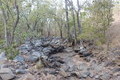
 | 43°S 146°E 26.2 km (16.3 miles) S of Strathgordon, Tasmania, TAS, Australia [incomplete] [28-Oct-12] |
 | 43°S 147°E 3.4 km (2.1 miles) WNW of Ranelagh, Tasmania, TAS, Australia [24-Oct-12] |
 | 41°S 147°E 5.1 km (3.2 miles) NE of Beechford, Tasmania, TAS, Australia [incomplete] [09-Oct-12] |
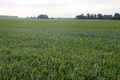
 | 40°N 82°W 1.5 miles (2.4 km) N of North Zanesville, Muskingum, OH, USA [15-Sep-12] |
 | 42°N 2°E 1.4 km (0.9 miles) E of Santa Maria de Merlès, Barcelona, Cataluña, Spain [12-Aug-12] |
 | 42°N 1°E 1.9 km (1.2 miles) N of Santa Maria de Meià, Lleida, Cataluña, Spain [11-Aug-12] |
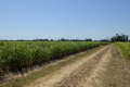
 | 46°N 128°E 9.0 km (5.6 miles) NW of Mulan, Hēilóngjiāng, China [29-Jul-12] |
 | 46°N 129°E 15.6 km (9.7 miles) E of Wuyapao, Hēilóngjiāng, China [28-Jul-12] |
 | 47°N 130°E 7.3 km (4.5 miles) WSW of Yude, Hēilóngjiāng, China [27-Jul-12] |