|
France : Pays de la Loire
2.2 km (1.4 miles) NW of Souligné-Flacé, Sarthe, Pays de la Loire, France
Approx. altitude: 115 m
(377 ft)
([?] maps: Google MapQuest OpenStreetMap ConfluenceNavigator)
Antipode: 48°S 180°
Accuracy: 10 m (32 ft)
Quality: good
Click on any of the images for the full-sized picture.
| 48°N 0° (visit #8) |
 (visited by David Williams) 06-Jun-2019 -- Parking is easy and it is just a short walk from your car to the confluence point The only difficulty was getting through the barbed wire fence. Otherwise its a pleasant walk through hay meadow and around the edge of arable fields (maize again) Plenty of evidence of a healthy deer population - be careful if visiting in the hunting season. I am in France for the D-Day 75 commemoration. My Uncle landed on Gold Beach, second wave, H-Hour+1 and his platoon made it furthest inland of any group that day. |
| All pictures |
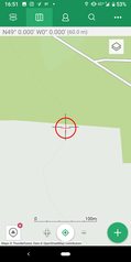
| #1: The Confluence Point #2: View Looking North #3: View Looking East #4: View Looking South #5: View Looking West #6: All the Zeros #7: View from the road toward the confluence point #8: Access is possible for the slim #9: Deer bedroom ALL: All pictures on one page |


![Visit #10: [07-Sep-24] Visit #10: [07-Sep-24]](/fr/all/n48e000v10/preview.jpg)
![Visit #9: [07-Jun-22] Visit #9: [07-Jun-22]](/fr/all/n48e000v9/preview.jpg)
![Visit #7: [29-Dec-17] Visit #7: [29-Dec-17]](/fr/all/n48e000v7/preview.jpg)
![Visit #6: [03-Sep-16] Visit #6: [03-Sep-16]](/fr/all/n48e000v6/preview.jpg)
![Visit #5: [05-Jun-13] Visit #5: [05-Jun-13]](/fr/all/n48e000v5/preview.jpg)
![Visit #4: [10-Sep-09] Visit #4: [10-Sep-09]](/fr/all/n48e000v4/preview.jpg)
![Visit #3: [31-Dec-06] Visit #3: [31-Dec-06]](/fr/all/n48e000v3/preview.jpg)
![Visit #2: [17-Aug-01] Visit #2: [17-Aug-01]](/fr/all/n48e000v2/preview.jpg)
![Visit #1: [01-Aug-01] Visit #1: [01-Aug-01]](/fr/all/n48e000/preview.jpg)