|
Germany : Brandenburg
1.9 km (1.2 miles) S of Lindow (Mark)-Banzendorf, Brandenburg, Germany
Approx. altitude: 47 m
(154 ft)
([?] maps: Google MapQuest OpenStreetMap ConfluenceNavigator)
Antipode: 53°S 167°W
Accuracy: 3 m (9 ft)
Quality: good
Click on any of the images for the full-sized picture.
| 53°N 13°E (visit #13) |
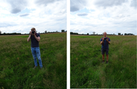
 (visited by Karl Bryk and Michael Bryk) 04-Aug-2020 -- This the sixth of 14 CP visits made during a road trip through the Czech republic and Germany. The previous is N52 E14. The next is N53 E13.
|
| All pictures |
| #1: Overview #2: North #3: East #4: South #5: West #6: GPS #7: Visitors #8: On the way to the CP #9: Bad Road ALL: All pictures on one page |


![Visit #15: [08-Feb-24] Visit #15: [08-Feb-24]](/de/all/n53e013v15/preview.jpg)
![Visit #12: [13-May-16] Visit #12: [13-May-16]](/de/all/n53e013v12/preview.jpg)
![Visit #11: [07-Oct-15] Visit #11: [07-Oct-15]](/de/all/n53e013v11/preview.jpg)
![Visit #10: [30-Sep-13] Visit #10: [30-Sep-13]](/de/all/n53e013v10/preview.jpg)
![Visit #9: [24-Jul-13] Visit #9: [24-Jul-13]](/de/all/n53e013v9/preview.jpg)
![Visit #8: [28-Oct-11] Visit #8: [28-Oct-11]](/de/all/n53e013v8/preview.jpg)
![Visit #14: [27-Aug-11] Visit #14: [27-Aug-11]](/de/all/n53e013v14/preview.jpg)
![Visit #7: [16-Oct-10] Visit #7: [16-Oct-10]](/de/all/n53e013v7/preview.jpg)
![Visit #5: [05-Dec-08] Visit #5: [05-Dec-08]](/de/all/n53e013v5/preview.jpg)
![Visit #4: [09-May-04] Visit #4: [09-May-04]](/de/all/n53e013v4/preview.jpg)
![Visit #3: [01-Jan-04] Visit #3: [01-Jan-04]](/de/all/n53e013v3/preview.jpg)
![Visit #2: [12-Aug-02] Visit #2: [12-Aug-02]](/de/all/n53e013v2/preview.jpg)
![Visit #1: [01-Apr-01] Visit #1: [01-Apr-01]](/de/all/n53e013/preview.jpg)
![Visit #6: [20-Aug-10] Visit #6: [20-Aug-10]](/de/all/n53e013v6/preview.jpg)