|
Germany : Niedersachsen
2.0 km (1.3 miles) SSW of Munster-Alvern, Niedersachsen, Germany
Approx. altitude: 86 m
(282 ft)
([?] maps: Google MapQuest OpenStreetMap ConfluenceNavigator)
Antipode: 53°S 170°W
Accuracy: 4 m (13 ft)
Quality: good
Click on any of the images for the full-sized picture.
| 53°N 10°E (visit #18) |
 (visited by Karl Bryk and Michael Bryk) 05-Aug-2020 -- This the ninth of 14 CP visits made during a road trip through the Czech republic and Germany. The previous is N53 E11. The next is N52 E10.
|
| All pictures |
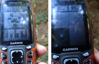
| #1: Overview #2: North #3: East #4: South #5: West #6: GPS #7: Visitors #8: Railway line crossed on the way to the CP ALL: All pictures on one page |


![Visit #24: [11-Aug-24] Visit #24: [11-Aug-24]](/de/all/n53e010v24/preview.jpg)
![Visit #22: [19-Jun-23] Visit #22: [19-Jun-23]](/de/all/n53e010v22/preview.jpg)
![Visit #20: [15-Jun-22] Visit #20: [15-Jun-22]](/de/all/n53e010v20/preview.jpg)
![Visit #19: [12-Sep-21] Visit #19: [12-Sep-21]](/de/all/n53e010v19/preview.jpg)
![Visit #21: [14-Jun-19] Visit #21: [14-Jun-19]](/de/all/n53e010v21/preview.jpg)
![Visit #16: [24-Feb-19] Visit #16: [24-Feb-19]](/de/all/n53e010v16/preview.jpg)
![Visit #15: [03-Jan-16] Visit #15: [03-Jan-16]](/de/all/n53e010v15/preview.jpg)
![Visit #14: [13-Jul-13] Visit #14: [13-Jul-13]](/de/all/n53e010v14/preview.jpg)
![Visit #13: [26-Jun-11] Visit #13: [26-Jun-11]](/de/all/n53e010v13/preview.jpg)
![Visit #11: [18-May-11] Visit #11: [18-May-11]](/de/all/n53e010v11/preview.jpg)
![Visit #17: [07-May-11] Visit #17: [07-May-11]](/de/all/n53e010v17/preview.jpg)
![Visit #10: [18-Jun-10] Visit #10: [18-Jun-10]](/de/all/n53e010v10/preview.jpg)
![Visit #9: [08-Oct-09] Visit #9: [08-Oct-09]](/de/all/n53e010v9/preview.jpg)
![Visit #8: [20-Mar-09] Visit #8: [20-Mar-09]](/de/all/n53e010v8/preview.jpg)
![Visit #7: [03-Jan-09] Visit #7: [03-Jan-09]](/de/all/n53e010v7/preview.jpg)
![Visit #6: [28-Apr-07] Visit #6: [28-Apr-07]](/de/all/n53e010v6/preview.jpg)
![Visit #4: [02-May-04] Visit #4: [02-May-04]](/de/all/n53e010v4/preview.jpg)
![Visit #5: [09-Mar-02] Visit #5: [09-Mar-02]](/de/all/n53e010v5/preview.jpg)
![Visit #3: [16-Apr-01] Visit #3: [16-Apr-01]](/de/all/n53e010v3/preview.jpg)
![Visit #2: [14-Apr-01] Visit #2: [14-Apr-01]](/de/all/n53e010v2/preview.jpg)
![Visit #23: [31-Dec-23] Visit #23: [31-Dec-23]](/de/all/n53e010v23/preview.jpg)
![Visit #1: [12-Apr-01] Visit #1: [12-Apr-01]](/de/all/n53e010/preview.jpg)