|


Germany : Bayern
near Scheßlitz-Windischletten, Bayern, Germany
Approx. altitude: 347 m
(1138 ft)
([?] maps: Google MapQuest OpenStreetMap ConfluenceNavigator)
Antipode: 50°S 169°W
Accuracy: 3 m (9 ft)
Quality: good
Click on any of the images for the full-sized picture.
| 50°N 11°E (visit #20) | (secondary) |
![Visit #18: [21-Jul-21]](/de/all/n50e011v18/preview.jpg "Visit #18: [21-Jul-21]")
![Visit #17: [19-Sep-15]](/de/all/n50e011v17/preview.jpg "Visit #17: [19-Sep-15]")
![Visit #16: [21-Aug-14]](/de/all/n50e011v16/preview.jpg "Visit #16: [21-Aug-14]")
![Visit #15: [22-Jan-12]](/de/all/n50e011v15/preview.jpg "Visit #15: [22-Jan-12]")
![Visit #14: [15-Aug-10]](/de/all/n50e011v14/preview.jpg "Visit #14: [15-Aug-10]")
![Visit #13: [04-Apr-10]](/de/all/n50e011v13/preview.jpg "Visit #13: [04-Apr-10]")
![Visit #12: [19-Jan-10]](/de/all/n50e011v12/preview.jpg "Visit #12: [19-Jan-10]")
![Visit #11: [03-Mar-09]](/de/all/n50e011v11/preview.jpg "Visit #11: [03-Mar-09]")
![Visit #10: [02-Aug-08]](/de/all/n50e011v10/preview.jpg "Visit #10: [02-Aug-08]")
![Visit #9: [07-Dec-07]](/de/all/n50e011v9/preview.jpg "Visit #9: [07-Dec-07]")
![Visit #8: [07-Oct-07]](/de/all/n50e011v8/preview.jpg "Visit #8: [07-Oct-07]")
![Visit #5: [05-May-05]](/de/all/n50e011v5/preview.jpg "Visit #5: [05-May-05]")
![Visit #4: [12-Jun-04]](/de/all/n50e011v4/preview.jpg "Visit #4: [12-Jun-04]")
![Visit #3: [15-Sep-02]](/de/all/n50e011v3/preview.jpg "Visit #3: [15-Sep-02]")
![Visit #2: [28-Oct-01]](/de/all/n50e011v2/preview.jpg "Visit #2: [28-Oct-01]")
![Visit #1: [20-Jan-01]](/de/all/n50e011/preview.jpg "Visit #1: [20-Jan-01]")
![Visit #19: [26-Jul-14]](/de/all/n50e011v19/preview.jpg "Visit #19: [26-Jul-14]")
![Visit #7: [31-Jul-05]](/de/all/n50e011v7/preview.jpg "Visit #7: [31-Jul-05]")
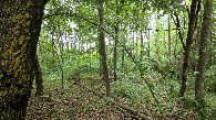
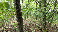
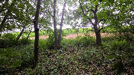
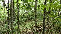
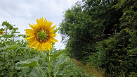
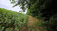
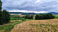
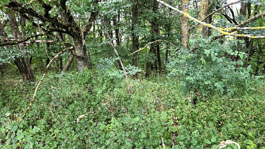 (visited by Thomas Schoch) 08-Jul-2026 -- Im Sommer 2026 vollende ich gemeinsam mit meinem Freund die Durchquerung Deutschlands auf dem 50. Breitengrad mit dem Fahrrad. Auf zwei der sieben Tagestouren kann ich (jeweils mit einem kleinen Solo-Abstecher) einen Konfluenzpunkt erreichen – hier ist es 50°N 11°E. Heute radeln wir von Bamberg nach Bayreuth. Die Route führt durch traumhaft schöne Landschaft und hübsche Ortschaften; am Wege liegen ansehnliche Kirchen und Schlösser und die beiden ersten Breitengrad-Markierungen dieser Etappe. Ganz besonders genießen wir den strapaziösen, aber sehr lohnenden Aufstieg durch das von hohen Felsen gesäumte Tal des Burglesauer Baches. Der Konfluenzpunkt liegt in einem Wäldchen in einer bäuerlich geprägten, hügeligen Kulturlandschaft. Man erreicht ihn über einen schmalen Pfad zwischen dem Wald und einem angrenzenden Sonnenblumenfeld, von dem aus man noch einige Meter in den Wald hineingehen muss. Nach einigem Hin und Her sehe ich in meinem GPS-Reciever, dass ich den Konfluenzpunkt erreicht habe.Meine Radtouren (und auch wenige Wanderungen) zu Konfluenzpunkten dokumentiere ich hier auf Komoot. 08-Jul-2026 -- In the summer of 2026, I am completing a bike ride across Germany along the 50th parallel with my friend. On two of the seven daily stages, I am able to reach a confluence point—in this case, 50°N 11°E—by making a brief solo detour. Today, we are cycling from Bamberg to Bayreuth. The route takes us through stunning scenery and charming villages; along the way, we pass impressive churches and castles, as well as the first two latitude markers of this leg. We particularly enjoy the strenuous yet highly rewarding climb through the Burglesau Creek valley, flanked by towering cliffs. The confluence point is located in a small wood within a hilly, agricultural landscape. It is accessible via a narrow path running between the woods and an adjacent sunflower field; from there, you have to walk a few more meters into the trees. After moving back and forth a bit, I see on my GPS receiver that I have reached the confluence point.I document my bike rides (and also a few hikes) to confluence points here on Komoot. |
| All pictures |
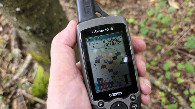
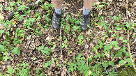
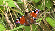
| #1: confluence point from the south, distance 20 m #2: view north #3: view west #4: view south #5: view east #6: GPS reading #7: ground at CP #8: European peacock #9: Path between sunflower field and forest #10: Path between sunflower field and forest #11: The confluence point is located to the right in the forest. ALL: All pictures on one page |