|


Spain : Galicia
2.3 km (1.4 miles) SE of Nogueira, La Coruña, Galicia, Spain
Approx. altitude: 731 m
(2398 ft)
([?] maps: Google MapQuest OpenStreetMap ConfluenceNavigator)
Antipode: 43°S 172°E
Accuracy: 3 m (9 ft)
Quality: good
Click on any of the images for the full-sized picture.
| 43°N 8°W (visit #6) |
![Visit #5: [03-May-23]](/es/all/n43w008v5/preview.jpg "Visit #5: [03-May-23]")
![Visit #4: [29-Apr-23]](/es/all/n43w008v4/preview.jpg "Visit #4: [29-Apr-23]")
![Visit #3: [09-Oct-07]](/es/all/n43w008v3/preview.jpg "Visit #3: [09-Oct-07]")
![Visit #2: [25-Jul-05]](/es/all/n43w008v2/preview.jpg "Visit #2: [25-Jul-05]")
![Visit #1: [25-Nov-01]](/es/all/n43w008/preview.jpg "Visit #1: [25-Nov-01]")
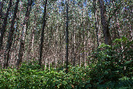
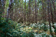
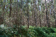
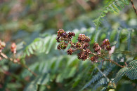
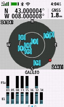
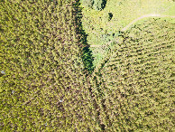
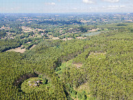
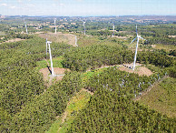
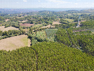
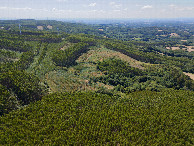
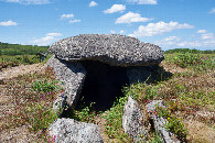
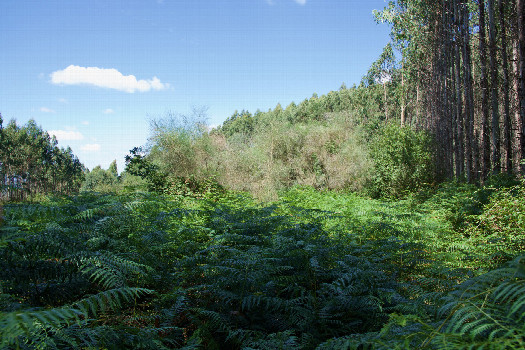 (visited by Ross Finlayson) 05-Aug-2026 -- Being from the other side of the world, it fascinates me to see trees from the Antipodes growing here in Spain. Earlier today, in A Coruña, I saw several pohutukawa trees (native to New Zealand). And while driving to this nearby Degree Confluence Point, I saw several commercial forests of eucalyptus trees (native to Australia). In fact, the Degree Confluence Point itself lies on the edge of one of these eucalyptus forests. Like previous visitors, I was curious about why eucalyptus trees were being grown commercially here, in such a wildfire-prone region. I did a Google search, and found this blog post claiming that there has been local pushback against these eucalyptus forests. Before visiting the point, I stopped at the 5000-year-old "Dolmen Forno Dos Mouros” at [43.01188,-7.97589], about 2.4km NE of the point. I then approached the point using the service roads for the nearby wind farm. I was able to get just 250m East of the point by parking next to a wind turbine at [42.99971,-7.99696]. From there it was an easy hike to the point, using the spaces between the rows of eucalyptus trees. The only problem was negotiating gorse and blackberry vines. When I got to the point, I found that it was on the edge of a clearing. A blackberry bush prevented me from getting closer than 1m (+/- GPS error of 2m) from the point. I was able to launch my drone from the edge of this clearing, but unfortunately the drone’s video function was malfunctioning, so this time I was able only to get aerial photos - no video. |
| All pictures |
| #1: The confluence point lies on the edge of a commercial eucalyptus forest. (This is also a view to the North, showing the forest just to the right.) #2: View East #3: View South #4: View West #5: Ground cover (blackberries) at the confluence point #6: As close to all zeros as I could get (GPS+Galileo+BeiDou) #7: Looking down on the point from a height of 120m #8: View North, from 120m above the point #9: View East (of the nearby windfarm), from 120m above the point #10: View South, from 120m above the point #11: View West, from 120m above the point #12: The nearby "Dolmen Forno Dos Mouros” ALL: All pictures on one page |