|

France : Nouvelle-Aquitaine
3.9 km (2.4 miles) SSW of Sindères, Landes, Nouvelle-Aquitaine, France
Approx. altitude: 88 m
(288 ft)
([?] maps: Google MapQuest OpenStreetMap ConfluenceNavigator)
Antipode: 44°S 179°E
Accuracy: 5 m (16 ft)
Quality: good
Click on any of the images for the full-sized picture.


| 44°N 1°W (visit #1) |
![Visit #9: [14-Jul-25]](/fr/all/n44w001v9/preview.jpg "Visit #9: [14-Jul-25]")
![Visit #8: [12-May-23]](/fr/all/n44w001v8/preview.jpg "Visit #8: [12-May-23]")
![Visit #5: [26-Jul-18]](/fr/all/n44w001v5/preview.jpg "Visit #5: [26-Jul-18]")
![Visit #6: [12-Jul-18]](/fr/all/n44w001v6/preview.jpg "Visit #6: [12-Jul-18]")
![Visit #7: [28-Mar-18]](/fr/all/n44w001v7/preview.jpg "Visit #7: [28-Mar-18]")
![Visit #4: [10-Apr-16]](/fr/all/n44w001v4/preview.jpg "Visit #4: [10-Apr-16]")
![Visit #3: [14-Jul-14]](/fr/all/n44w001v3/preview.jpg "Visit #3: [14-Jul-14]")
![Visit #2: [22-Aug-05]](/fr/all/n44w001v2/preview.jpg "Visit #2: [22-Aug-05]")

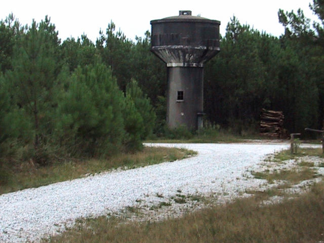
(visited by Michel Dupuis and Christian Nabarro) 08-Sep-2001 -- 44N001W and 45N001W are quite typical views of the "Landes" landscape: a flat area with exploited pine trees over fern and bramble. We visited 44N001W coming from Morcenx. Leaving south-west, we first used the small road linking Garrosse to Le Bouscat. At a small water tower, shown on the Michelin map, we turned north on a dirt track and left the car at a point 200 meters from the confluence (N44°00.053 W001°00.132). Both of us, accompanied by Leda, Christian's daughter's dog, who had some trouble jumping among the bramble and bushes, went to the spot. The altitude there is 101 meters, and the gps accuracy was perfect (5 meters). |
| All pictures |
| #1: Arrival to the spot #2: Christian and Leda on the spot #3: me on the spot #4: view south from the confluence #5: the GPS on the spot #6: the water tower where you leave the road towards the confluence ALL: All pictures on one page |