|

France : Centre-Val de Loire
6.1 km (3.8 miles) NNW of Saint-Flovier, Indre-et-Loire, Centre-Val de Loire, France
Approx. altitude: 140 m
(459 ft)
([?] maps: Google MapQuest OpenStreetMap ConfluenceNavigator)
Antipode: 47°S 179°W
Accuracy: 33 m (108 ft)
Quality: good
Click on any of the images for the full-sized picture.


| 47°N 1°E (visit #1) |
![Visit #8: [11-Feb-23]](/fr/all/n47e001v8/preview.jpg "Visit #8: [11-Feb-23]")
![Visit #7: [09-Oct-20]](/fr/all/n47e001v7/preview.jpg "Visit #7: [09-Oct-20]")
![Visit #6: [29-Jul-18]](/fr/all/n47e001v6/preview.jpg "Visit #6: [29-Jul-18]")
![Visit #5: [03-Jul-18]](/fr/all/n47e001v5/preview.jpg "Visit #5: [03-Jul-18]")
![Visit #4: [22-Dec-17]](/fr/all/n47e001v4/preview.jpg "Visit #4: [22-Dec-17]")
![Visit #3: [14-May-10]](/fr/all/n47e001v3/preview.jpg "Visit #3: [14-May-10]")
![Visit #2: [01-Jan-10]](/fr/all/n47e001v2/preview.jpg "Visit #2: [01-Jan-10]")

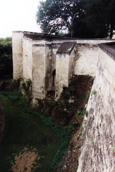
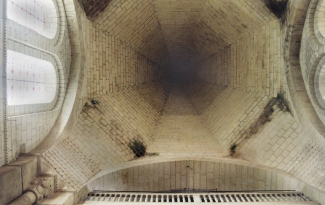
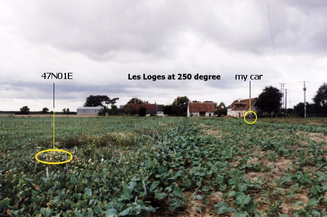
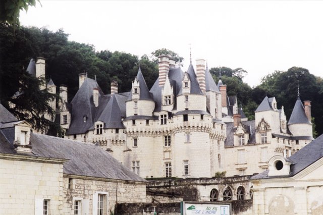
(visited by Henk Pouwels) 31-Aug-2001 -- The morning of the 31st of August 2001 found my wife and me in France, about 100 km south-west of Orleans, more precisely Loches. Never heard off Loches? Neither did we, but that is the fun of DCP hunting. Loches is one of those smaller very old cities in France with a very well kept medieval fortified town, situated at the borders of the Indre, a navigable river leading to the river Loire at Tours. After a small coffee we visited the walls, see photograph #3, and looked in amazement at the peculiar roof construction of the church; a kind of cones build with stones like an igloo is built. See photograph #4 and #5 for a vertical view from the inside. Back to the car and driving about 14 km to the south we rather easily found our way as is depicted in image #2 by the plot of our track in purple. We parked the car at a farm and I walked north-east along the border of two fields, almost bare soil at the left and a kind of cabbage at right. This cabbage is a crop for the winter, it is used as a green fertilizer and for feeding cattle, it was not the first time I met this cabbage. Photograph #1 shows the DCP point and a view of the area in the direction of the farm. The farm is called "Les Loges" which means "The Cabins". The views in other directions showed rather flat fields with trees at the horizon without any remarkable landmarks. As I ran short of film I didn't take any more photographs except for the display of my GPS which proves the visit as close as 0.018 minutes latitude which equals 33 meter. We proceeded with our holiday in western direction heading for Chinon, one of the famous wine areas of the Loire. But the Loire region is also famous for the beautiful castles. If you ever visit the region go to Ussé, close to Chinon and visit the castle of the Sleeping Beauty. See photograph #6 and be amazed, coordinates 47N14.88 / 00E17.43 This castle is not build for tourism. It started as a fortress in the 11th century and was mainly rebuilt on the foundations of the old castle in the 15th and 16th century. It is still inhabited but parts of it can be visited. The French writer Perrault was inspired by this castle to write the fairy tale of the Sleeping Beauty and others stories. |
| All pictures |
| #1: In the field. #2: Map and Display #3: Medieval walls of Loches #4: Church of Loches #5: Roof construction, in inside view #6: The castle of the Sleeping Beauty in Ussé. ALL: All pictures on one page |