|

United Kingdom : England
1.9 km (1.2 miles) N of Alderton, Gloucestershire, England, United Kingdom
Approx. altitude: 61 m
(200 ft)
([?] maps: Google MapQuest OpenStreetMap ConfluenceNavigator)
Antipode: 52°S 178°E
Accuracy: 5 m (16 ft)
Quality: good
Click on any of the images for the full-sized picture.


| 52°N 2°W (visit #2) | (secondary) |
![Visit #18: [31-Jul-23]](/uk/en/n52w002v18/preview.jpg "Visit #18: [31-Jul-23]")
![Visit #16: [09-Jun-22]](/uk/en/n52w002v16/preview.jpg "Visit #16: [09-Jun-22]")
![Visit #17: [27-Sep-19]](/uk/en/n52w002v17/preview.jpg "Visit #17: [27-Sep-19]")
![Visit #15: [22-Dec-15]](/uk/en/n52w002v15/preview.jpg "Visit #15: [22-Dec-15]")
![Visit #14: [06-Jul-12]](/uk/en/n52w002v14/preview.jpg "Visit #14: [06-Jul-12]")
![Visit #13: [14-Apr-12]](/uk/en/n52w002v13/preview.jpg "Visit #13: [14-Apr-12]")
![Visit #12: [11-Aug-10]](/uk/en/n52w002v12/preview.jpg "Visit #12: [11-Aug-10]")
![Visit #11: [28-Aug-06]](/uk/en/n52w002v11/preview.jpg "Visit #11: [28-Aug-06]")
![Visit #10: [18-Mar-06]](/uk/en/n52w002v10/preview.jpg "Visit #10: [18-Mar-06]")
![Visit #9: [10-Jul-05]](/uk/en/n52w002v9/preview.jpg "Visit #9: [10-Jul-05]")
![Visit #8: [30-May-05]](/uk/en/n52w002v8/preview.jpg "Visit #8: [30-May-05]")
![Visit #7: [09-Apr-05]](/uk/en/n52w002v7/preview.jpg "Visit #7: [09-Apr-05]")
![Visit #6: [06-Mar-05]](/uk/en/n52w002v6/preview.jpg "Visit #6: [06-Mar-05]")
![Visit #5: [31-May-04]](/uk/en/n52w002v5/preview.jpg "Visit #5: [31-May-04]")
![Visit #4: [31-Jan-04]](/uk/en/n52w002v4/preview.jpg "Visit #4: [31-Jan-04]")
![Visit #3: [12-Oct-02]](/uk/en/n52w002v3/preview.jpg "Visit #3: [12-Oct-02]")
![Visit #1: [08-Jun-00]](/uk/en/n52w002/preview.jpg "Visit #1: [08-Jun-00]")

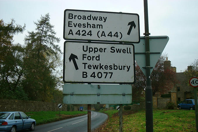
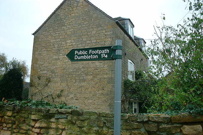
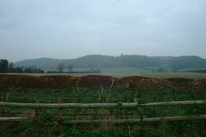
(visited by Gordon Spence) 16-Nov-2001 -- Here we go again, I am going to visit a customer site and this confluence is on the way, well sort of, not too far out of the way anyway. Besides, two in three days, three in eight days, why not? I checked the record of the previous visit and noticed from the GPS shot that the accuracy appeared to be 67m, knowing that I can do better than that made this a good candidate. I left nice and early in case I got stuck in traffic, this was a working day after all and it wouldn't do to keep customers waiting! Here's a trivial pursuit question for you, did you know that the road number to reach this confluence point is the same as the number of the hospital in the tv series MASH? That's right 4077. I arrived at the village and swung around to the other side of it, parking up by the entrance to a public footpath which the GPS indicated was about 200 yards from the point. The path lead between some houses, through a small field with a couple of horses in and on past the back of some gardens. There were a couple of tracks with "Private, Keep Out" on but lucky for me they were heading in the wrong direction. It looks like what had been a wheat field last year had been left fallow this year. The point was about 30 yards from the footpath. Hmmm...the only living things I had seen were the horses, go and knock a couple of doors, the ones behind the field. No reply, so going back to the point I stepped over the fence (two feet high!) and walked to the point. The field only had grass in so no harm was done. I duly took the north facing shot. The presence of the farmers manure heap lending credence to my idea that the field had been fallow this year and was going to be used next year. Time for the locating shots, on my other four confluences to date the shots of the GPS have all been clear and sharp, I don't know what happened today, but if you look carefully you can see that the position shot clearly shows five zero's on both longitude and latitude. This was followed by the accuracy shot, showing 11 satellites and 15 feet. When I walked back to the car I noticed opposite me, what some would consider to the very essence of a way of British life and a fast disappearing species - the red telephone box, all modern ones are glass and steel monstrosities. It's fun this isn't it? Five and counting....oh yes, the customers - made it with ten minutes to spare! |
| All pictures |
| #1: On the spot looking North #2: Heading for MASH or confluence point? #3: No problems with access here! #4: Exactly in the right place #5: Accurate enough #6: A red public phone box, not many left... ALL: All pictures on one page |