|


Luxembourg
0.5 km (0.3 miles) E of Wilwerwiltz-Enscherange, Diekirch, Luxembourg
Approx. altitude: 392 m
(1286 ft)
([?] maps: Google MapQuest OpenStreetMap ConfluenceNavigator)
Antipode: 50°S 174°W
Quality: good
Click on any of the images for the full-sized picture.
| 50°N 6°E (visit #33) |
![Visit #31: [21-Apr-23]](/lu/all/n50e006v31/preview.jpg "Visit #31: [21-Apr-23]")
![Visit #29: [28-Aug-19]](/lu/all/n50e006v29/preview.jpg "Visit #29: [28-Aug-19]")
![Visit #28: [02-Aug-19]](/lu/all/n50e006v28/preview.jpg "Visit #28: [02-Aug-19]")
![Visit #30: [17-Jun-19]](/lu/all/n50e006v30/preview.jpg "Visit #30: [17-Jun-19]")
![Visit #27: [24-Sep-15]](/lu/all/n50e006v27/preview.jpg "Visit #27: [24-Sep-15]")
![Visit #26: [03-Jan-15]](/lu/all/n50e006v26/preview.jpg "Visit #26: [03-Jan-15]")
![Visit #24: [06-Nov-13]](/lu/all/n50e006v24/preview.jpg "Visit #24: [06-Nov-13]")
![Visit #23: [02-Sep-12]](/lu/all/n50e006v23/preview.jpg "Visit #23: [02-Sep-12]")
![Visit #25: [02-Aug-12]](/lu/all/n50e006v25/preview.jpg "Visit #25: [02-Aug-12]")
![Visit #22: [24-Jul-12]](/lu/all/n50e006v22/preview.jpg "Visit #22: [24-Jul-12]")
![Visit #21: [20-Aug-11]](/lu/all/n50e006v21/preview.jpg "Visit #21: [20-Aug-11]")
![Visit #20: [18-Apr-10]](/lu/all/n50e006v20/preview.jpg "Visit #20: [18-Apr-10]")
![Visit #19: [28-Jan-09]](/lu/all/n50e006v19/preview.jpg "Visit #19: [28-Jan-09]")
![Visit #18: [15-Aug-08]](/lu/all/n50e006v18/preview.jpg "Visit #18: [15-Aug-08]")
![Visit #17: [18-May-08]](/lu/all/n50e006v17/preview.jpg "Visit #17: [18-May-08]")
![Visit #16: [11-Mar-07]](/lu/all/n50e006v16/preview.jpg "Visit #16: [11-Mar-07]")
![Visit #15: [14-Oct-06]](/lu/all/n50e006v15/preview.jpg "Visit #15: [14-Oct-06]")
![Visit #14: [28-Jan-06]](/lu/all/n50e006v14/preview.jpg "Visit #14: [28-Jan-06]")
![Visit #13: [04-Sep-05]](/lu/all/n50e006v13/preview.jpg "Visit #13: [04-Sep-05]")
![Visit #12: [17-Jul-05]](/lu/all/n50e006v12/preview.jpg "Visit #12: [17-Jul-05]")
![Visit #11: [16-May-05]](/lu/all/n50e006v11/preview.jpg "Visit #11: [16-May-05]")
![Visit #10: [05-May-05]](/lu/all/n50e006v10/preview.jpg "Visit #10: [05-May-05]")
![Visit #9: [28-Oct-04]](/lu/all/n50e006v9/preview.jpg "Visit #9: [28-Oct-04]")
![Visit #8: [13-Aug-04]](/lu/all/n50e006v8/preview.jpg "Visit #8: [13-Aug-04]")
![Visit #7: [03-Aug-04]](/lu/all/n50e006v7/preview.jpg "Visit #7: [03-Aug-04]")
![Visit #6: [29-May-04]](/lu/all/n50e006v6/preview.jpg "Visit #6: [29-May-04]")
![Visit #5: [29-May-04]](/lu/all/n50e006v5/preview.jpg "Visit #5: [29-May-04]")
![Visit #4: [25-Apr-04]](/lu/all/n50e006v4/preview.jpg "Visit #4: [25-Apr-04]")
![Visit #3: [21-Feb-04]](/lu/all/n50e006v3/preview.jpg "Visit #3: [21-Feb-04]")
![Visit #2: [10-Nov-02]](/lu/all/n50e006v2/preview.jpg "Visit #2: [10-Nov-02]")
![Visit #1: [11-Jun-00]](/lu/all/n50e006/preview.jpg "Visit #1: [11-Jun-00]")
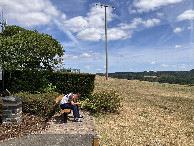
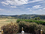
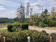
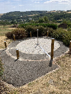
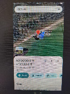
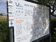
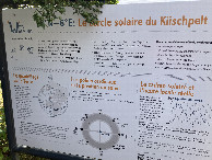
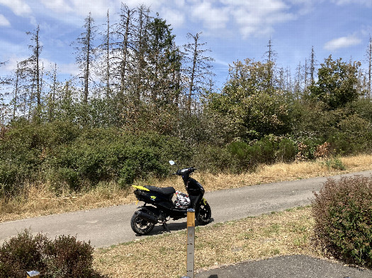 (visited by Herman de Haan) 23-Jul-2026 -- We visited this confluencepoint a couple of years ago (02-08-2019). Today we passed it unintentionally. This was a surprise and we actually did not remember our first visit very clearly. Our aim in Luxembourg was to hike the Lee trail and a part of the Eislek trail. On the first part of the Eislek trail from Kautenbach to Crevaux the path passes the confluence point. As you can see the coniferous trees seem to be almost dead (photo north). In 2019 the trees still look healthy. In 2023, not anymore. It has been a very extraordinary dry summer this year, as you can see the grass is not green anymore. |
| All pictures |
| #1: North #2: East #3: South #4: West #5: Confluence point #6: Google Maps #7: Info #8: Info2 ALL: All pictures on one page |