
| { Main | Search | Countries | Information | Member Page } | |
Older Confluence Visits (10200 to 10249) |
This list is based on the date the confluence visit is posted to the site (not the date of the visit).
|
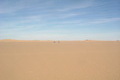
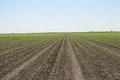
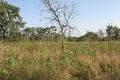
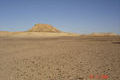
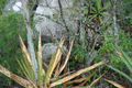
24°N 29°E 165.1 km (102.5 miles) S of Mūt, al-Wādiy al-Jadīd, Egypt [30-Nov-06] |
|
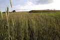
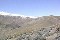
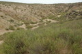
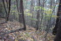
38°N 117°W 13.4 miles (21.6 km) ESE of Tonopah, Nye, NV, USA [28-Nov-06] |

|
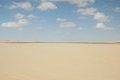
18°N 49°E 93.8 km (58.2 miles) NNE of Hisn al-Jawābiha, Hadramawt, Yemen [28-Nov-06] |
|
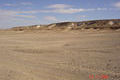
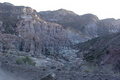
28°N 31°E 16.5 km (10.2 miles) ENE of al-Karm al-Šarqiyy (al-Minyā), al-Bahr al-Ahmar, Egypt [28-Nov-06] |
|
33°S 67°W 20.3 km (12.6 miles) NW of El Portezuelo, San Luis, Argentina [28-Nov-06] |
|
28°S 64°W 4.1 km (2.5 miles) NNW of Jumial, Santiago del Estero, Argentina [27-Nov-06] |
|
26°S 67°W 38.8 km (24.1 miles) ESE of Cara Ciénaga, Catamarca, Argentina [27-Nov-06] |
|
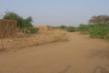
13°N 8°E 11.7 km (7.3 miles) SSW of Babauri, Katsina, Nigeria [27-Nov-06] |
|
17°N 8°E 1.9 km (1.2 miles) S of Alarsas, Agadez, Niger [27-Nov-06] |
|
11°N 8°W 1.9 km (1.2 miles) N of Ntabako, Sikasso, Mali [27-Nov-06] |
|
51°N 20°E 1.2 km (0.7 miles) W of Kajetanów, Łódzkie, Poland [secondary] [26-Nov-06] |
|
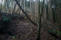
38°N 118°W 6.7 miles (10.8 km) WSW of Coaldale, Esmeralda, NV, USA [26-Nov-06] |
|
20°S 68°W 24.5 km (15.2 miles) E of Sapaya, Potosí, Bolivia [26-Nov-06] |
|
15°S 75°W 4.1 km (2.5 miles) SSW of Paroma, Ica, Peru [26-Nov-06] |
|
19°S 70°W 4.1 km (2.5 miles) NNW of Conanoxa, Tarapacá, Chile [25-Nov-06] |
|
16°S 74°W 2.4 km (1.5 miles) ESE of Puerto Viejo, Arequipa, Peru [25-Nov-06] |
|
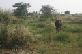
10°S 67°W 16.4 km (10.2 miles) WNW of Pelotas, Acre, Brazil [25-Nov-06] |
|
50°N 12°E 1.2 km (0.7 miles) W of Bad Alexandersbad-Kleinwendern, Bayern, Germany [25-Nov-06] |
|
28°N 82°W 2.7 miles (4.3 km) S of Winston, Polk, FL, USA [25-Nov-06] |
|
11°S 49°W 28.2 km (17.5 miles) SSW of São José, Tocantins, Brazil [25-Nov-06] |
|
16°N 97°W 4.1 km (2.5 miles) NNW of Tiltepec, Oaxaca, Mexico [incomplete] [24-Nov-06] |
|
11°N 69°W 2.6 km (1.6 miles) SE of Santa Cruz, Falcón, Venezuela [24-Nov-06] |
|
10°S 51°W 68.2 km (42.4 miles) WNW of Chico Roberto, Mato Grosso, Brazil [24-Nov-06] |
|
37°S 69°W 27.8 km (17.3 miles) S of Jagüel de las Chilcas, Mendoza, Argentina [24-Nov-06] |

|
27°N 82°W 0.6 miles (1.0 km) NNE of Harbour Heights, Charlotte, FL, USA [24-Nov-06] |
|
52°N 22°E 1.9 km (1.2 miles) S of Soćki, Lubelskie, Poland [24-Nov-06] |
|
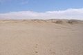
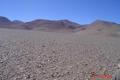
29°N 17°E 75.8 km (47.1 miles) NW of Zilla, al-Jufra, Libya [24-Nov-06] |
|
29°N 18°E 64.5 km (40.1 miles) NE of Zilla (al-Jufra), Surt, Libya [24-Nov-06] |
|
59°N 17°E near Norsborg, Södermanland, Sweden [secondary] [23-Nov-06] |
|
59°N 16°E near Rosendal, Södermanland, Sweden [23-Nov-06] |
|
25°N 100°W 10.7 km (6.6 miles) ESE of El Barreal, Nuevo León, Mexico [23-Nov-06] |
|
36°S 70°W 16.0 km (9.9 miles) SSE of Minacar, Mendoza, Argentina [23-Nov-06] |
|
26°N 26°E 229.0 km (142.2 miles) WSW of Qasr al-Farāfira, al-Wādiy al-Jadīd, Egypt [23-Nov-06] |
|
35°S 69°W 14.2 km (8.8 miles) ESE of Agua Nueva, Mendoza, Argentina [incomplete] [22-Nov-06] |
|
35°S 68°W 13.8 km (8.6 miles) W of Soitué, Mendoza, Argentina [22-Nov-06] |
|
35°S 66°W 10.7 km (6.6 miles) ENE of Tres Amigos, San Luis, Argentina [22-Nov-06] |
|
35°S 65°W 6.3 km (3.9 miles) NNW of Chamaicó, Pampa, Argentina [22-Nov-06] |
|
31°N 109°W 15.7 km (9.7 miles) NE of Peñasquito, Sonora, Mexico [22-Nov-06] |
|
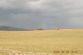
40°N 109°E 9.6 km (6.0 miles) SSW of Tara Gol, Nèi Měnggǔ, China [22-Nov-06] |
|
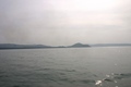
18°N 73°E 2.2 km (1.4 miles) S of Srīvardhan Point (Cape), Maharashtra, India [22-Nov-06] |
|
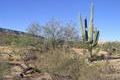
32°N 111°W 3.9 miles (6.3 km) NW of Sahuarita, Pima, AZ, USA [22-Nov-06] |
|
47°N 92°E 12.8 km (7.9 miles) NW of Tsenher, Hovd, Mongolia [20-Nov-06] |
|
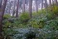
36°N 138°E 1.9 km (1.2 miles) N of Tatsuno, Tatsuno-machi, Nagano-ken, Chubu, Japan [20-Nov-06] |
|
36°N 137°E 7.2 km (4.5 miles) SE of Makido, Takayama-shi, Gifu-ken, Chubu, Japan [20-Nov-06] |
|
36°N 136°E 4.0 km (2.5 miles) SSW of Kumizaki, Koshino-mura, Fukui-ken, Chubu, Japan [20-Nov-06] |

|
37°N 137°E 2.4 km (1.5 miles) NW of Kumabuchi, Nanao-shi, Ishikawa-ken, Chubu, Japan [20-Nov-06] |
|
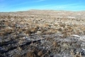
41°N 113°W 15.1 miles (24.3 km) NNW of Low (Tooele), Box Elder, UT, USA [20-Nov-06] |
|
52°N 21°E near Pęchery, Mazowieckie, Poland [19-Nov-06] |
|
42°N 73°W 1.6 miles (2.6 km) WSW of West Hartland, Hartford, CT, USA [19-Nov-06] |
|
39°N 108°E 10.5 km (6.5 miles) S of Ulan, Nèi Měnggǔ, China [19-Nov-06] |