
| { Main | Search | Countries | Information | Member Page } | |
Older Confluence Visits (4523 to 4572) |
This list is based on the date the confluence visit is posted to the site (not the date of the visit).
|
61°N 29°E 3.1 km (1.9 miles) SW of Prudy, Leningradskaya oblast', Russia [secondary] [06-Oct-13] |
|
50°N 89°E 9.0 km (5.6 miles) N of Kokorya, Respublika Altay, Russia [incomplete] [secondary] [06-Oct-13] |
|
56°N 70°E 3.6 km (2.2 miles) E of Oktyabriovka, Tyumenskaya oblast', Russia [05-Oct-13] |
|
55°N 68°E 2.0 km (1.2 miles) WSW of Matasy, Kurganskaya oblast', Russia [incomplete] [secondary] [05-Oct-13] |
|
55°N 64°E 7.8 km (4.8 miles) NE of Rybnoye, Kurganskaya oblast', Russia [05-Oct-13] |
|
55°N 63°E 2.0 km (1.2 miles) WNW of Maylyk, Kurganskaya oblast', Russia [05-Oct-13] |
|
56°N 67°E 11.6 km (7.2 miles) ESE of Topolyovka, Tyumenskaya oblast', Russia [incomplete] [05-Oct-13] |
|
56°N 66°E 5.2 km (3.2 miles) SSW of Tyumentseva (Tyumenskaya oblast'), Kurganskaya oblast', Russia [05-Oct-13] |
|
12°S 76°W 6.1 km (3.8 miles) ESE of Collquepucro (Lima), Junín, Peru [03-Oct-13] |
|
12°S 42°W 5.2 km (3.2 miles) NW of Milagre, Bahia, Brazil [02-Oct-13] |

|
1°S 37°E 5.2 km (3.2 miles) SE of Makwa, Kiambu, Central, Kenya [incomplete] [02-Oct-13] |
|
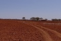
37°N 103°W 7.3 miles (11.7 km) NNW of Kenton (OK), Baca, CO, USA [30-Sep-13] |

|
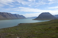
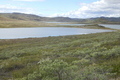
61°N 9°E 12.0 km (7.4 miles) W of Fagernes, Oppland, Norway [29-Sep-13] |
|
56°N 38°E 2.1 km (1.3 miles) E of Komyagino, Moskovskaya oblast', Russia [secondary] [29-Sep-13] |

|
58°N 51°E 4.9 km (3.0 miles) NNW of Zabolonoye, Kirovskaya oblast', Russia [incomplete] [28-Sep-13] |
|
58°N 29°E 2.8 km (1.7 miles) SSW of Podlozh'ye, Pskovskaya oblast', Russia [secondary] [23-Sep-13] |
|
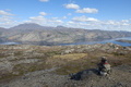
61°N 10°E 19.0 km (11.8 miles) N of Dokka, Oppland, Norway [20-Sep-13] |
|
37°N 104°W 3.9 miles (6.4 km) SE of Trinchera, Las Animas, CO, USA [17-Sep-13] |
|
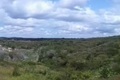
30°S 30°E 3.1 km (1.9 miles) SW of Masameni, KwaZulu-Natal, South Africa [16-Sep-13] |
|
60°N 11°E 17.0 km (10.5 miles) NE of Oslo, Akershus, Norway [secondary] [16-Sep-13] |
|
58°N 12°E 1.9 km (1.2 miles) S of Hålt, Västra Götaland, Sweden [13-Sep-13] |
|
57°N 13°E 1.9 km (1.2 miles) N of Häshult, Halland, Sweden [11-Sep-13] |
|
56°N 12°E 1.0 km (0.6 miles) E of Frederiksværk-Melby, Sjælland (Island), Frederiksborg, Denmark [11-Sep-13] |
|
56°N 13°E 2.1 km (1.3 miles) E of Skromberga, Skåne, Sweden [11-Sep-13] |
|
59°N 15°E near Hylle, Örebro, Sweden [incomplete] [09-Sep-13] |
|
58°N 15°E 4.7 km (2.9 miles) NE of Ryggestorp, Jönköping, Sweden [09-Sep-13] |
|
56°N 14°E 1.0 km (0.6 miles) W of Ovesholm, Skåne, Sweden [secondary] [09-Sep-13] |

|
55°N 12°E 1.1 km (0.7 miles) E of Vordingborg-Vintersbølle, Seeland (Island), Storstrøm, Denmark [09-Sep-13] |
|
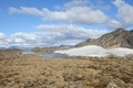
70°N 54°W 38.5 km (23.9 miles) WSW of Qullissat, Vestgrønland, Greenland [incomplete] [09-Sep-13] |

|
67°N 54°W 16.0 km (9.9 miles) WNW of Holsteinborg, Vestgrønland, Greenland [incomplete] [09-Sep-13] |
|
67°N 53°W 12.5 km (7.8 miles) NNW of Sarfannguaq, Vestgrønland, Greenland [secondary] [09-Sep-13] |
|
67°N 52°W 25.2 km (15.6 miles) NE of Saqqarliit, Vestgrønland, Greenland [incomplete] [09-Sep-13] |
|
67°N 51°W 3.4 km (2.1 miles) WNW of Camp Lloyd, Vestgrønland, Greenland [secondary] [09-Sep-13] |

|
67°N 50°W 30.4 km (18.9 miles) E of Søndre Strømfjord, Vestgrønland, Greenland [incomplete] [09-Sep-13] |

|
43°N 88°W 1.2 miles (1.9 km) SSE of West Allis, Milwaukee, WI, USA [08-Sep-13] |
|
47°N 95°W 3.8 miles (6.1 km) NW of Dorset, Hubbard, MN, USA [08-Sep-13] |
|
50°N 51°E 17.5 km (10.9 miles) SSE of Malyy Zheleznov, Batys Qazaqstan, Kazakhstan [07-Sep-13] |
|
49°N 50°E 2.6 km (1.6 miles) W of Mukhor, Batys Qazaqstan, Kazakhstan [secondary] [07-Sep-13] |
|
49°N 49°E 5.8 km (3.6 miles) NW of Iskra, Batys Qazaqstan, Kazakhstan [07-Sep-13] |
|
49°N 48°E 11.0 km (6.8 miles) NNW of Zhambyl, Batys Qazaqstan, Kazakhstan [07-Sep-13] |
|
49°N 47°E 7.6 km (4.7 miles) NNW of Zhermenke, Batys Qazaqstan, Kazakhstan [secondary] [07-Sep-13] |
|
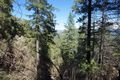
41°N 124°W 2.7 miles (4.3 km) NE of Fieldbrook, Humboldt, CA, USA [04-Sep-13] |
|
56°N 13°E 2.1 km (1.3 miles) E of Skromberga, Skåne, Sweden [04-Sep-13] |
|
41°N 122°W 5.4 miles (8.7 km) WSW of Big Bend, Shasta, CA, USA [03-Sep-13] |
|
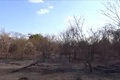
10°S 38°W 7.5 km (4.7 miles) WSW of Serra Negra, Bahia, Brazil [incomplete] [03-Sep-13] |
|
11°S 42°W 8.2 km (5.1 miles) ENE of Queimada Nova, Bahia, Brazil [02-Sep-13] |
|
11°S 43°W 5.8 km (3.6 miles) WSW of Utinga, Bahia, Brazil [02-Sep-13] |
|
11°S 41°W 5.8 km (3.6 miles) WNW of Pau de Colher, Bahia, Brazil [02-Sep-13] |

|
4°S 43°W 3.7 km (2.3 miles) S of Saquinho, Maranhão, Brazil [28-Aug-13] |
|
1°S 48°W 7.6 km (4.7 miles) SSW of Perseverança, Pará, Brazil [28-Aug-13] |