|
Germany : Brandenburg
2.9 km (1.8 miles) NE of Märkische Heide-Biebersdorf, Brandenburg, Germany
Approx. altitude: 63 m
(206 ft)
([?] maps: Google MapQuest OpenStreetMap ConfluenceNavigator)
Antipode: 52°S 166°W
Accuracy: 8 m (26 ft)
Quality: good
Click on any of the images for the full-sized picture.
| 52°N 14°E (visit #15) | (secondary) |
 (visited by Karl Bryk and Michael Bryk) 03-Aug-2020 -- This the fourth of 14 CP visits made during a road trip through the Czech republic and Germany. The previous is N51 E14. The next is N53 E14.
|
| All pictures |
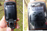
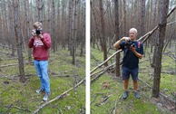
| #1: Overview #2: North #3: East #4: South #5: West #6: GPS #7: Visitors #8: On the way to the CP #9: Return to the car #10: Warnings ALL: All pictures on one page |


![Visit #18: [27-Apr-25] Visit #18: [27-Apr-25]](/de/all/n52e014v18/preview.jpg)
![Visit #17: [03-Jan-24] Visit #17: [03-Jan-24]](/de/all/n52e014v17/preview.jpg)
![Visit #13: [28-Jul-13] Visit #13: [28-Jul-13]](/de/all/n52e014v13/preview.jpg)
![Visit #12: [25-Jul-13] Visit #12: [25-Jul-13]](/de/all/n52e014v12/preview.jpg)
![Visit #16: [16-May-13] Visit #16: [16-May-13]](/de/all/n52e014v16/preview.jpg)
![Visit #14: [20-May-12] Visit #14: [20-May-12]](/de/all/n52e014v14/preview.jpg)
![Visit #11: [26-Oct-11] Visit #11: [26-Oct-11]](/de/all/n52e014v11/preview.jpg)
![Visit #9: [19-Aug-10] Visit #9: [19-Aug-10]](/de/all/n52e014v9/preview.jpg)
![Visit #8: [08-Sep-08] Visit #8: [08-Sep-08]](/de/all/n52e014v8/preview.jpg)
![Visit #6: [10-Jan-07] Visit #6: [10-Jan-07]](/de/all/n52e014v6/preview.jpg)
![Visit #7: [30-Jun-06] Visit #7: [30-Jun-06]](/de/all/n52e014v7/preview.jpg)
![Visit #5: [19-Aug-05] Visit #5: [19-Aug-05]](/de/all/n52e014v5/preview.jpg)
![Visit #4: [17-Apr-05] Visit #4: [17-Apr-05]](/de/all/n52e014v4/preview.jpg)
![Visit #3: [18-Apr-04] Visit #3: [18-Apr-04]](/de/all/n52e014v3/preview.jpg)
![Visit #2: [20-Aug-02] Visit #2: [20-Aug-02]](/de/all/n52e014v2/preview.jpg)
![Visit #1: [17-Jun-01] Visit #1: [17-Jun-01]](/de/all/n52e014/preview.jpg)
![Visit #10: [17-May-11] Visit #10: [17-May-11]](/de/all/n52e014v10/preview.jpg)