
| { Main | Search | Countries | Information | Member Page } | |
Older Confluence Visits (11423 to 11472) |
This list is based on the date the confluence visit is posted to the site (not the date of the visit).

|
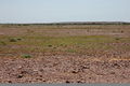
22°S 120°E 16.9 km (10.5 miles) SW of Nullagine, WA, Australia [16-Nov-05] |

|
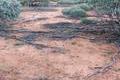
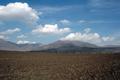
24°S 121°E 92.1 km (57.2 miles) E of Capricorn, WA, Australia [incomplete] [16-Nov-05] |
|
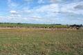
26°S 135°E 62.8 km (39.0 miles) SE of Finke, NT, Australia [16-Nov-05] |
|
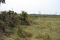
34°S 143°E 17.7 km (11.0 miles) SE of Arumpo, NSW, Australia [16-Nov-05] |

|
36°S 68°W 31.7 km (19.7 miles) ENE of La Escondida (Mendoza), Pampa, Argentina [16-Nov-05] |

|
36°S 69°W 33.4 km (20.7 miles) ENE of Jagüel Amarillo, Mendoza, Argentina [16-Nov-05] |

|
36°S 66°W 16.0 km (9.9 miles) ESE of Nueva Constitución (San Luis), Pampa, Argentina [15-Nov-05] |

|
35°S 143°E 11.6 km (7.2 miles) ESE of Bolton, VIC, Australia [15-Nov-05] |

|
29°N 108°W 9.3 km (5.8 miles) N of Agoreachic, Chihuahua, Mexico [15-Nov-05] |
|
34°S 58°W 9.4 km (5.8 miles) WSW of Campana, Colonia, Uruguay [15-Nov-05] |
|
15°S 52°W 34.3 km (21.3 miles) E of Pindaíba, Mato Grosso, Brazil [15-Nov-05] |

|
37°S 175°E 10.3 km (6.4 miles) NNE of Papakura, Auckland, N. Island, NZ [15-Nov-05] |

|
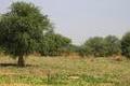
15°S 35°E 5.7 km (3.5 miles) ESE of Balaka, Southern, Malawi [15-Nov-05] |
|
37°N 102°E 17.3 km (10.7 miles) NNW of Weiyuan, Qīnghǎi, China [15-Nov-05] |

|
11°N 13°E 2.6 km (1.6 miles) NE of Bulagarga, Borno, Nigeria [15-Nov-05] |

|
12°N 14°E 4.1 km (2.5 miles) ESE of Antul, Borno, Nigeria [15-Nov-05] |
|
12°N 13°E 4.1 km (2.5 miles) NNW of Grema Abduri, Borno, Nigeria [15-Nov-05] |

|
13°N 13°E 0.8 km (0.5 miles) E of Garunda, Borno, Nigeria [15-Nov-05] |
|
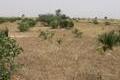
12°N 12°E 7.5 km (4.7 miles) WSW of Malewa, Yobe, Nigeria [15-Nov-05] |
|
13°N 11°E 2.6 km (1.6 miles) SE of Jawa, Yobe, Nigeria [15-Nov-05] |
|
12°N 11°E 5.3 km (3.3 miles) ESE of Tarajim, Yobe, Nigeria [15-Nov-05] |

|
22°S 138°E 51.8 km (32.2 miles) W of Carrandotta, QLD, Australia [15-Nov-05] |
|
40°S 69°W 11.5 km (7.1 miles) W of Aguada de Guzmán, Río Negro, Argentina [14-Nov-05] |

|
15°S 53°W 61.2 km (38.0 miles) N of Colônia Sagrado Coração de Jesus, Mato Grosso, Brazil [14-Nov-05] |
|
8°N 70°W near Providencia, Barinas, Venezuela [14-Nov-05] |

|
40°S 64°W 24.8 km (15.4 miles) NNE of Boca de la Travesía, Río Negro, Argentina [14-Nov-05] |
|
22°N 70°E 6.5 km (4.0 miles) SSE of Gunra, Gujarat, India [13-Nov-05] |

|
39°N 119°W 8.8 miles (14.2 km) E of Yerington, Lyon, NV, USA [12-Nov-05] |
|
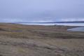
80°N 86°W 1.7 km (1.1 miles) NW of Eureka, Ellesmere Island, NU, Canada [secondary] [11-Nov-05] |

|
26°S 32°E 1.9 km (1.2 miles) S of Lomahasha, Lubombo, Eswatini [11-Nov-05] |
|
16°N 49°E 3.6 km (2.2 miles) W of al-Rawġa, Hadramawt, Yemen [11-Nov-05] |

|
15°N 49°E 14.1 km (8.8 miles) NNE of Jirwid, Hadramawt, Yemen [11-Nov-05] |

|
23°N 58°E 2.5 km (1.6 miles) SSE of Mahram, al-Dākhiliyya, Oman [10-Nov-05] |

|
37°N 101°W 4.8 miles (7.7 km) NE of Tyrone (OK), Seward, KS, USA [10-Nov-05] |
|
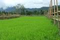
19°N 102°E 6.5 km (4.0 miles) WNW of Ban Na Kang Pa, Viangchan, Laos [incomplete] [10-Nov-05] |

|
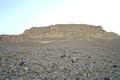
25°N 12°E 170.2 km (105.7 miles) ESE of al-`Uwaynāt (Ġāt), Murzuq, Libya [10-Nov-05] |

|
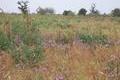
19°S 19°E 6.4 km (4.0 miles) SW of Vorstershoop, Otjozondjupa, Namibia [09-Nov-05] |

|
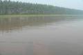
10°N 104°E 2.6 km (1.6 miles) NW of Hòn Dứa (Island), Kiến Giang, Vietnam [09-Nov-05] |

|
14°N 121°E 4.1 km (2.5 miles) SSW of Tabla, Luzon, Batangas, Philippines [incomplete] [08-Nov-05] |

|
32°N 110°E 6.8 km (4.2 miles) W of Guandu, Húběi, China [07-Nov-05] |

|
33°N 110°E 1.1 km (0.7 miles) SW of Liulangguan, Húběi, China [07-Nov-05] |

|
33°N 111°E 4.8 km (3.0 miles) NNE of Baisang, Húběi, China [07-Nov-05] |

|
32°N 112°E 1.0 km (0.6 miles) SSW of Longzhong, Húběi, China [07-Nov-05] |

|
32°N 113°E 4.4 km (2.7 miles) SE of Suiyang, Húběi, China [07-Nov-05] |

|
31°N 113°E 9.1 km (5.7 miles) S of Sunqiao, Húběi, China [07-Nov-05] |

|
31°N 112°E 8.6 km (5.3 miles) NW of Yandun, Húběi, China [07-Nov-05] |
|
30°N 112°E 4.0 km (2.5 miles) NNW of Shizikou, Húběi, China [07-Nov-05] |

|
30°N 113°E 5.2 km (3.2 miles) WNW of Fenyan, Húběi, China [07-Nov-05] |
|
31°N 115°E 4.5 km (2.8 miles) SSW of Baiguo, Húběi, China [07-Nov-05] |

|
31°N 116°E 3.7 km (2.3 miles) ESE of Taohuachong, Húběi, China [07-Nov-05] |