
| { Main | Search | Countries | Information | Member Page } | |
Older Confluence Visits (11873 to 11922) |
This list is based on the date the confluence visit is posted to the site (not the date of the visit).
|
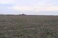
52°N 84°E 1.3 km (0.8 miles) ENE of Anton'yevka, Altayskiy kray, Russia [03-Aug-05] |

|
51°N 85°E 8.9 km (5.5 miles) WNW of Yakonur, Respublika Altay, Russia [03-Aug-05] |
|
50°N 88°E 12.5 km (7.8 miles) WNW of Kyzylmany, Respublika Altay, Russia [03-Aug-05] |
|
50°N 89°E 9.0 km (5.6 miles) N of Kokorya, Respublika Altay, Russia [secondary] [03-Aug-05] |
|
33°N 80°E 11.6 km (7.2 miles) SSW of Küba, Xīzàng (Tibet), China [02-Aug-05] |
|
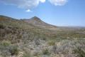
29°N 104°W 8.5 km (5.3 miles) SE of Juan Grande, Chihuahua, Mexico [02-Aug-05] |
|
38°S 64°W 18.5 km (11.5 miles) SW of Abramo, Pampa, Argentina [01-Aug-05] |

|
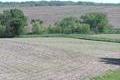
40°N 83°W 2.0 miles (3.2 km) SW of Linden, Columbus, Franklin, OH, USA [01-Aug-05] |

|
40°N 84°W 3.3 miles (5.2 km) W of North Hampton, Clark, OH, USA [01-Aug-05] |
|
59°N 11°E 3.5 km (2.2 miles) SW of Skjærhollen, Østfold, Norway [secondary] [01-Aug-05] |
|
28°N 54°E 9.6 km (6.0 miles) SE of Mārmeh, Fārs, Iran [01-Aug-05] |
|
27°N 55°E 3.4 km (2.1 miles) E of Podol, Hormozgān, Iran [01-Aug-05] |
|
34°S 18°E 27.9 km (17.3 miles) W of Duiker Point (Cape), Western Cape, South Africa [01-Aug-05] |
|
34°S 26°E 27.4 km (17.0 miles) E of Cape Recife (Cape), Eastern Cape, South Africa [01-Aug-05] |
|
48°N 31°E 5.9 km (3.7 miles) SE of Myhiya, Mykolayivs'ka Oblast', Ukraine [incomplete] [31-Jul-05] |

|
49°N 27°E near Maliyevtsy, Khmel'nyts'ka Oblast', Ukraine [incomplete] [31-Jul-05] |
|
54°N 35°E 1.8 km (1.1 miles) N of Semichastnoye, Kaluzhskaya oblast', Russia [secondary] [31-Jul-05] |
|
49°N 33°E 2.5 km (1.6 miles) N of Yaremovka, Kirovohrads'ka Oblast', Ukraine [31-Jul-05] |
|
49°N 33°E 2.5 km (1.6 miles) N of Yaremovka, Kirovohrads'ka Oblast', Ukraine [31-Jul-05] |
|
49°N 32°E 1.6 km (1.0 miles) ENE of Verbovka, Cherkas'ka Oblast', Ukraine [secondary] [31-Jul-05] |
|
49°N 32°E 1.6 km (1.0 miles) ENE of Verbovka, Cherkas'ka Oblast', Ukraine [secondary] [31-Jul-05] |
|
56°N 35°E 2.1 km (1.3 miles) E of Dolgiye Nivy, Tverskaya oblast', Russia [secondary] [31-Jul-05] |

|
53°N 25°E 2.2 km (1.4 miles) SW of Selyavichy, Hrodzyenskaya Voblasts', Belarus [31-Jul-05] |

|
49°N 34°E SE of Proshchyurady, Poltavs'ka Oblast', Ukraine [31-Jul-05] |
|
58°N 33°E 1.5 km (0.9 miles) W of Varnitsy, Novgorodskaya oblast', Russia [31-Jul-05] |
|
57°N 58°E 1.1 km (0.7 miles) S of Bol'shoy Ut, Sverdlovskaya oblast', Russia [31-Jul-05] |
|
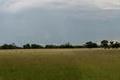
36°S 64°W 12.9 km (8.0 miles) NW of Villa Mirasol, Pampa, Argentina [28-Jul-05] |
|
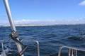
8°N 65°W 9.5 km (5.9 miles) S of El Rodeo, Anzoátegui, Venezuela [28-Jul-05] |
|
8°N 66°W 15.7 km (9.7 miles) SW of Torrealba, Guárico, Venezuela [28-Jul-05] |
|
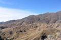
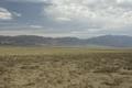
22°S 65°W 7.6 km (4.7 miles) SW of Camacho, Tarija, Bolivia [28-Jul-05] |
|
48°N 11°E 2.0 km (1.2 miles) N of Dießen a.A.-Obermühlhausen, Bayern, Germany [27-Jul-05] |
|
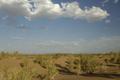
13°S 132°E 24.8 km (15.4 miles) SE of Mount Bundey, NT, Australia [27-Jul-05] |
|
41°N 97°W 3.0 miles (4.8 km) ESE of Bee, Seward, NE, USA [27-Jul-05] |
|
41°N 95°W 5.0 miles (8.1 km) NNW of Villisca, Montgomery, IA, USA [27-Jul-05] |
|
41°N 96°W 6.2 miles (10.0 km) WSW of Plattsmouth, Cass, NE, USA [27-Jul-05] |

|
46°N 68°W 3.2 miles (5.2 km) SW of Linneus, Aroostook, ME, USA [26-Jul-05] |

|
21°N 39°E 27.0 km (16.8 miles) SW of al-Ġubba, Makka, Saudi Arabia [incomplete] [26-Jul-05] |
|
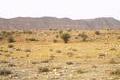
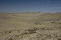
45°N 100°E 41.5 km (25.8 miles) NW of Örgön, Bayanhongor, Mongolia [25-Jul-05] |
|
44°N 102°E 32.0 km (19.9 miles) W of Dugang Goliin Hural, Ömnögovĭ, Mongolia [25-Jul-05] |
|
45°N 105°E 30.8 km (19.1 miles) SSE of Hashaat, Dundgovĭ, Mongolia [25-Jul-05] |

|
5°N 8°E near Mbak Ikot Abasi, Akwa Ibom, Nigeria [incomplete] [25-Jul-05] |

|
5°N 8°E near Mbak Ikot Abasi, Akwa Ibom, Nigeria [incomplete] [25-Jul-05] |

|
25°N 48°E 10.8 km (6.7 miles) SSW of Khurays, al-Šarqiyya, Saudi Arabia [23-Jul-05] |
|
57°N 14°E 1.9 km (1.2 miles) N of Dörarp, Kronoberg, Sweden [secondary] [22-Jul-05] |

|
57°N 15°E 2.0 km (1.2 miles) W of Skårtaryd, Kronoberg, Sweden [22-Jul-05] |
|
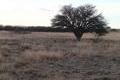
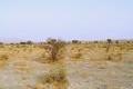
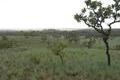
20°S 25°E 5.8 km (3.6 miles) NNE of Khama Khama, North-West, Botswana [22-Jul-05] |
|
35°N 50°E 3.2 km (2.0 miles) S of Rāzīn, Markazī, Iran [22-Jul-05] |
|
45°N 132°E 5.7 km (3.5 miles) SSE of Platono-Aleksandrovskoye, Primorskiy kray, Russia [21-Jul-05] |

|
56°N 36°E 0.9 km (0.6 miles) W of Bolshoye Nikolskoye, Moskovskaya oblast', Russia [21-Jul-05] |
|
67°N 30°E 13.0 km (8.1 miles) W of Yulyakurtti, Murmanskaya oblast', Russia [21-Jul-05] |