
| { Main | Search | Countries | Information | Member Page } | |
Ross Finlayson's confluences |
| Finlayson, Ross | homepage | |
| This Visitor does not have any Plans. | View confluence map | |
| 748 visits (624 unique) in 25 countries: | 747 active, 0 pending, 1 submitting | |
| 671 successful (570 unique): | 644 primary, 27 secondary | |
| 77 incomplete (77 unique): | 74 primary, 3 secondary | |
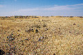
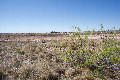
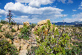
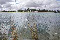
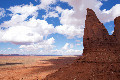
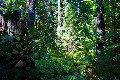
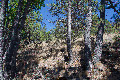
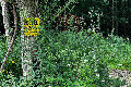
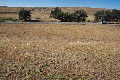
 | 36°N 110°W 14.4 miles (23.2 km) SE of Pinon (Navajo), Apache, AZ, USA [23-Apr-25] |
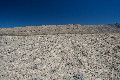
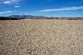
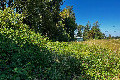
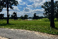
 | 36°N 109°W 3.7 miles (6.0 km) SW of Crystal (San Juan), McKinley, NM, USA [23-Apr-25] |
 | 29°S 168°E 7.4 km (4.6 miles) NE of Kingston, Norfolk Island [incomplete] [21-Mar-25] |
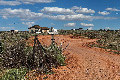
 | 28°S 115°E 15.2 km (9.4 miles) WNW of Dartmoor, WA, Australia [27-Oct-24] |
 | 24°S 114°E 50.3 km (31.2 miles) NW of Yandoo Creek, WA, Australia [23-Oct-24] |
 | 23°S 115°E 15.8 km (9.8 miles) SSE of Yannarie, WA, Australia [21-Oct-24] |
 | 20°S 120°E 48.5 km (30.1 miles) ENE of Pardoo, WA, Australia [19-Oct-24] |
 | 18°S 124°E 17.5 km (10.9 miles) WNW of Camballin, WA, Australia [17-Oct-24] |
 | 34°N 117°W 3.7 miles (5.9 km) E of Calimesa, Riverside, CA, USA [17-Sep-24] |
 | 47°N 118°W 8.3 miles (13.3 km) NE of Benge, Adams, WA, USA [09-Aug-24] |
 | 48°N 117°W 1.4 miles (2.2 km) S of Blanchard, Bonner, ID, USA [08-Aug-24] |
 | 48°N 114°W 2.3 miles (3.8 km) E of Woods Bay, Lake, MT, USA [07-Aug-24] |
 | 49°N 114°W 8.8 km (5.5 miles) SW of Waterton Park, AB, Canada [05-Aug-24] |
 | 50°N 113°W 6.0 km (3.7 miles) E of Barons, AB, Canada [secondary] [04-Aug-24] |
 | 50°N 114°W 3.1 km (1.9 miles) N of Furman, AB, Canada [incomplete] [04-Aug-24] |
 | 48°N 123°W 1.6 miles (2.5 km) S of Blyn, Clallam, WA, USA [16-Jul-24] |
 | 47°N 124°W 5.4 miles (8.7 km) WNW of Hoquiam, Grays Harbor, WA, USA [15-Jul-24] |
 | 46°N 122°W 14.8 miles (23.9 km) ESE of Cougar (Cowlitz), Skamania, WA, USA [14-Jul-24] |
 | 45°N 122°W 19.8 miles (31.8 km) NNE of Detroit (Marion), Clackamas, OR, USA [13-Jul-24] |
 | 44°N 122°W 30.0 miles (48.4 km) SW of Sisters (Deschutes), Lane, OR, USA [10-Jul-24] |
 | 43°N 121°W 9.0 miles (14.5 km) SSE of Silver Lake, Lake, OR, USA [08-Jul-24] |
 | 35°N 106°W 2.9 miles (4.6 km) ENE of Moriarty, Torrance, NM, USA [15-Apr-24] |
 | 35°N 102°W 4.8 miles (7.7 km) WNW of Canyon, Randall, TX, USA [15-Apr-24] |
 | 35°N 100°W 10.5 miles (16.9 km) NW of Vinson, Harmon, OK, USA [14-Apr-24] |
 | 35°N 97°W 3.2 miles (5.1 km) NE of Wanette, Pottawatomie, OK, USA [13-Apr-24] |
 | 35°N 96°W 4.5 miles (7.2 km) SSE of Scipio, Pittsburg, OK, USA [13-Apr-24] |
 | 36°N 94°W 0.4 miles (0.6 km) E of Elkins, Washington, AR, USA [11-Apr-24] |
 | 35°N 95°W 5.7 miles (9.1 km) NE of Red Oak, Latimer, OK, USA [09-Apr-24] |
 | 33°N 97°W 3.2 miles (5.1 km) S of Lewisville, Denton, TX, USA [08-Apr-24] |
 | 33°N 98°W 2.8 miles (4.5 km) NNE of Whitt, Parker, TX, USA [07-Apr-24] |
 | 33°N 101°W 11.2 miles (18.0 km) NE of Fluvanna (Scurry), Kent, TX, USA [05-Apr-24] |
 | 32°N 102°W 4.6 miles (7.4 km) E of Midland, Midland, TX, USA [05-Apr-24] |
 | 32°N 103°W 11.2 miles (18.0 km) NNE of Kermit, Winkler, TX, USA [04-Apr-24] |
 | 32°N 104°W 8.7 miles (14.1 km) NE of Red Bluff, Reeves, TX, USA [04-Apr-24] |
 | 32°N 105°W 12.5 miles (20.2 km) ENE of Dell City, Hudspeth, TX, USA [03-Apr-24] |
 | 33°N 106°W 3.7 miles (6.0 km) NW of La Luz, Otero, NM, USA [02-Apr-24] |
 | 45°S 170°E 6.6 km (4.1 miles) E of Oturehua, Otago, S. Island, NZ [23-Feb-24] |
 | 46°S 169°E 2.3 km (1.4 miles) SW of Maitland, Southland, S. Island, NZ [23-Feb-24] |
 | 46°N 0° 1.3 km (0.8 miles) E of Longré, Charente, Nouvelle-Aquitaine, France [17-Oct-23] |
 | 45°N 1°W 6.8 km (4.2 miles) ENE of Lacanau, Gironde, Nouvelle-Aquitaine, France [17-Oct-23] |
 | 44°N 0° 1.3 km (0.8 miles) E of Herré, Landes, Nouvelle-Aquitaine, France [17-Oct-23] |
 | 48°N 9°E 2.2 km (1.4 miles) SE of Buchheim, Baden-Württemberg, Germany [04-Oct-23] |
 | 49°N 10°E 1.9 km (1.2 miles) N of Bühlerzell-Röhmen, Baden-Württemberg, Germany [01-Oct-23] |
 | 46°N 6°E near Sallenôves, Haute-Savoie, Auvergne-Rhône-Alpes, France [26-Sep-23] |
 | 44°N 6°E 3.9 km (2.4 miles) SSE of Les Mées, Alpes-de-Haute-Provence, Provence-Alpes-Côte d'Azur, France [25-Sep-23] |
 | 44°N 5°E 3.7 km (2.3 miles) S of Monteux, Vaucluse, Provence-Alpes-Côte d'Azur, France [24-Sep-23] |
 | 44°N 4°E 2.3 km (1.4 miles) SW of Massillargues-Attuech, Gard, Occitanie, France [23-Sep-23] |
 | 43°N 3°E 1.9 km (1.2 miles) N of Lapalme, Aude, Occitanie, France [22-Sep-23] |
 | 43°N 2°E 1.4 km (0.9 miles) E of Sonnac-sur-l'Hers, Aude, Occitanie, France [18-Sep-23] |
 | 50°N 4°E 1.9 km (1.2 miles) S of Wignehies, Nord, Hauts-de-France, France [14-Sep-23] |
 | 51°N 2°E 3.0 km (1.9 miles) NE of Les Hemmes, Pas-de-Calais, Hauts-de-France, France [secondary] [13-Sep-23] |
 | 37°N 122°W 2.3 miles (3.7 km) NE of Santa Cruz, Santa Cruz, CA, USA [06-Aug-23] |
 | 37°N 106°W 5.5 miles (8.8 km) S of Antonito, Conejos, CO, USA [12-Jul-23] |
 | 36°N 106°W 0.8 miles (1.2 km) N of La Puebla, Santa Fe, NM, USA [10-Jul-23] |
 | 36°N 107°W 2.8 miles (4.5 km) SW of Cuba, Sandoval, NM, USA [08-Jul-23] |
 | 36°N 109°W 3.7 miles (6.0 km) SW of Crystal (San Juan), McKinley, NM, USA [incomplete] [07-Jul-23] |
 | 35°N 111°W 17.2 miles (27.7 km) W of Winslow (Navajo), Coconino, AZ, USA [07-Jul-23] |
 | 37°S 145°E 3.8 km (2.4 miles) W of Puckapunyal, VIC, Australia [incomplete] [03-Apr-23] |
 | 36°S 142°E 11.1 km (6.9 miles) S of Rainbow, VIC, Australia [01-Apr-23] |
 | 35°S 142°E 15.3 km (9.5 miles) N of Walpeup, VIC, Australia [01-Apr-23] |
 | 34°S 142°E 10.5 km (6.5 miles) ENE of Pomona, NSW, Australia [31-Mar-23] |
 | 35°S 143°E 11.6 km (7.2 miles) ESE of Bolton, VIC, Australia [30-Mar-23] |
 | 36°S 143°E 5.1 km (3.2 miles) W of Narraport, VIC, Australia [30-Mar-23] |
 | 35°S 144°E 10.7 km (6.6 miles) NNW of Moulamein, NSW, Australia [29-Mar-23] |
 | 36°S 144°E 4.7 km (2.9 miles) E of Loddon Vale, VIC, Australia [29-Mar-23] |
 | 33°N 112°W 5.0 miles (8.1 km) SE of Maricopa, Pinal, AZ, USA [12-Jan-23] |
 | 37°N 110°W 10.6 miles (17.1 km) SW of Halchita, San Juan, UT, USA [incomplete] [22-Sep-22] |
 | 38°N 114°W 1.7 miles (2.7 km) W of Hamlin Valley, Iron, UT, USA [18-Sep-22] |
 | 43°N 122°W 10.4 miles (16.7 km) SW of Diamond Lake Junction, Klamath, OR, USA [01-Sep-22] |
 | 46°N 121°W 14.0 miles (22.5 km) E of Glenwood, Klickitat, WA, USA [31-Aug-22] |
 | 47°N 123°W 1.7 miles (2.7 km) NE of Delphi, Thurston, WA, USA [29-Aug-22] |
 | 44°N 123°W 3.4 miles (5.4 km) SSE of Springfield, Lane, OR, USA [26-Aug-22] |
 | 42°N 122°W 5.0 miles (8.1 km) NW of Dorris, Siskiyou, CA, USA [24-Aug-22] |
 | 40°N 75°W 1.1 miles (1.8 km) SE of Riverton, Burlington, NJ, USA [incomplete] [10-Aug-22] |
 | 39°N 76°W 4.6 miles (7.4 km) SE of Centreville, Queen Anne's, MD, USA [09-Aug-22] |
 | 39°N 77°W 1.3 miles (2.0 km) NW of Langley Park (Prince George's), Montgomery, MD, USA [09-Aug-22] |
 | 40°N 79°W 3.5 miles (5.6 km) S of Friedens, Somerset, PA, USA [08-Aug-22] |
 | 40°N 80°W 0.2 miles (0.3 km) SW of Fredericktown, Washington, PA, USA [07-Aug-22] |
 | 41°N 80°W 2.8 miles (4.5 km) E of West Liberty, Butler, PA, USA [07-Aug-22] |
 | 42°N 80°W 4.0 miles (6.5 km) N of Waterford, Erie, PA, USA [07-Aug-22] |
 | 43°N 79°W 2.2 miles (3.6 km) W of Grand Island, Grand Island, Erie, NY, USA [06-Aug-22] |
 | 43°N 78°W 1.7 miles (2.7 km) NW of Le Roy, Genesee, NY, USA [05-Aug-22] |
 | 43°N 77°W 4.1 miles (6.6 km) NE of Phelps, Ontario, NY, USA [04-Aug-22] |
 | 43°N 76°W 1.2 miles (1.9 km) W of Manlius, Onondaga, NY, USA [incomplete] [04-Aug-22] |
 | 43°N 75°W 0.8 miles (1.3 km) SSE of Mohawk, Herkimer, NY, USA [03-Aug-22] |
 | 44°N 74°W 8.4 miles (13.5 km) ENE of Newcomb, Essex, NY, USA [incomplete] [03-Aug-22] |
 | 45°N 73°W 1.5 miles (2.4 km) SW of Morse's Line, Franklin, VT, USA [02-Aug-22] |
 | 44°N 73°W 7.3 miles (11.7 km) S of Lincoln, Addison, VT, USA [01-Aug-22] |
 | 43°N 74°W 2.0 miles (3.3 km) SE of Galway, Saratoga, NY, USA [01-Aug-22] |
 | 42°N 74°W 1.2 miles (1.9 km) NW of Lake Katrine, Ulster, NY, USA [31-Jul-22] |
 | 41°N 75°W 2.4 miles (3.9 km) NW of Blairstown, Warren, NJ, USA [31-Jul-22] |
 | 40°N 122°W 5.0 miles (8.1 km) ESE of Los Molinos, Tehama, CA, USA [08-Jul-22] |
 | 43°N 123°W 8.1 miles (13.0 km) ENE of Days Creek, Douglas, OR, USA [incomplete] [07-Jul-22] |
 | 42°N 121°W 11.8 miles (19.0 km) E of Langell Valley, Klamath, OR, USA [06-Jul-22] |
 | 41°N 120°W 10.9 miles (17.5 km) SSW of Reederville (NV), Lassen, CA, USA [06-Jul-22] |
 | 40°N 108°W 5.3 miles (8.5 km) WSW of Meeker, Rio Blanco, CO, USA [23-Jun-22] |
 | 42°N 109°W 16.4 miles (26.4 km) N of Superior, Sweetwater, WY, USA [incomplete] [21-Jun-22] |
 | 41°N 109°W 19.0 miles (30.6 km) W of Hiawatha, Moffatt, CO, USA [20-Jun-22] |
 | 41°N 110°W 5.8 miles (9.4 km) WSW of McKinnon, Sweetwater, WY, USA [20-Jun-22] |